
IMAGES TAKEN NEAR TO
Harrison Drive, CAMBRIDGE, CB2 8EF
Introduction
This page details the photographs taken nearby to Harrison Drive, CB2 8EF by members of the Geograph project.
The Geograph project started in 2005 with the aim of publishing, organising and preserving representative images for every square kilometre of Great Britain, Ireland and the Isle of Man.

There are currently over 7.5m images from over14,400 individuals and you can help contribute to the project by visiting https://www.geograph.org.uk
Image Map
Images are licensed for reuse under creativecommons.org/licenses/by-sa/2.0
Notes
- Clicking on the map will re-center to the selected point.
- The higher the marker number, the further away the image location is from the centre of the postcode.
Image Listing (636 Images Found)
Images are licensed for reuse under creativecommons.org/licenses/by-sa/2.0
Image
Details
Distance
1
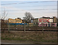
National Extension College being redeveloped
The plans, led by Homerton College, include a new boarding school and up to 95 new homes. See Image
Image: © Hugh Venables
Taken: 13 Mar 2015
0.01 miles
2
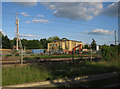
National Extension College being redeveloped
The plans, led by Homerton College, include a new boarding school and up to 95 new homes. See Image
Image: © Hugh Venables
Taken: 7 Jun 2015
0.01 miles
3

Rainclouds and a red crane
A view from the cycle path beside the guided busway towards one of the construction sites south of Hills Road Bridge. The first part of the morning had been cloudless and bright, but clouds were rolling in from the south west.
Image: © John Sutton
Taken: 12 Jan 2016
0.01 miles
5
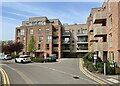
Harrison Road and Magna
Magna is a housing project by Homerton College and the developers Hill, on land between the college and the railway.
Image: © John Sutton
Taken: 1 Dec 2016
0.02 miles
6
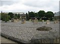
Low maintenance garden
Michael Young Centre, Purbeck Road.
Image: © Mr Ignavy
Taken: 27 Aug 2008
0.02 miles
7

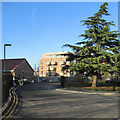
A green space in the Magna housing development
Magna is a housing project by Homerton College and the developers Hill, on land between the college and the railway which was previously occupied by Rattee & Kett, the celebrated Cambridge builders and stonemasons.
Image] shows these blocks being built in August 2016.
Image: © John Sutton
Taken: 17 Sep 2017
0.02 miles
8
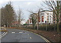
Built beside the railway
Flats and an independent sixth-form college backing on to the railway and reached from Hills Road. The colourful building is Abbey College. Hugh Venables’ Image] (June 2015) shows it under construction.
The picture was taken from the Cambridge University Press car park. The cyclist and pedestrians are on the path next to the guided busway, which runs parallel to the railway here.
Image: © John Sutton
Taken: 8 Jan 2017
0.02 miles
9
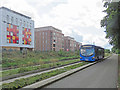
Cambridge: beside the busway
Whippet's Route U links Addenbrooke's Hospital, the city and Madingley Road Park & Ride. On the left, on the other side of the railway, are part of the colourful Abbey College and the Magna housing development.
Image: © John Sutton
Taken: 17 Aug 2017
0.02 miles
10

Building by the railway
Leaving Cambridge.
Image: © Fernweh
Taken: 22 Feb 2017
0.02 miles