
IMAGES TAKEN NEAR TO
Harrison Drive, CAMBRIDGE, CB2 8ED
Introduction
This page details the photographs taken nearby to Harrison Drive, CB2 8ED by members of the Geograph project.
The Geograph project started in 2005 with the aim of publishing, organising and preserving representative images for every square kilometre of Great Britain, Ireland and the Isle of Man.

There are currently over 7.5m images from over14,400 individuals and you can help contribute to the project by visiting https://www.geograph.org.uk
Image Map
Images are licensed for reuse under creativecommons.org/licenses/by-sa/2.0
Notes
- Clicking on the map will re-center to the selected point.
- The higher the marker number, the further away the image location is from the centre of the postcode.
Image Listing (486 Images Found)
Images are licensed for reuse under creativecommons.org/licenses/by-sa/2.0
Image
Details
Distance
1
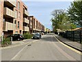
New homes along Harrison Drive
This was known as The Magna housing development. The site was previously occupied by a mix of light industrial buildings, including the Michael Young Centre. This image Image was taken in the same direction a few yards to the left of this photo. The tallest tree is a reference point.
Image: © Fernweh
Taken: 17 Apr 2022
0.01 miles
2
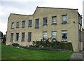
Converted office block
Housing Cambridge Editorial Partnership and Medical Transfer Services.
UPDATE 2022: This building was demolished quite a few years ago and the site is now a residential block known as Homerton Gardens.
Image: © Mr Ignavy
Taken: 27 Aug 2008
0.02 miles
3
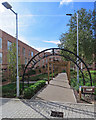
Remembering Rattee & Kett
Magna is a housing project by Homerton College and the developers Hill, on land between the college and the railway which was previously occupied by Rattee & Kett, the celebrated Cambridge builders and stonemasons.
Image: © John Sutton
Taken: 17 Sep 2017
0.02 miles
5
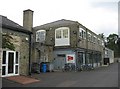
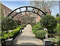
Scott Wilson offices - The Michael Young Centre
The name of the former company, Rattee & Kett, can still be seen in the brickwork. See http://www.ratteeandkett.co.uk/index.asp
Image: © Mr Ignavy
Taken: 27 Aug 2008
0.02 miles
6
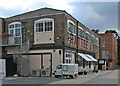
Cambridge Cookery School
The school, which includes a café, is part of the National Extension College, and is housed in a building once occupied by Rattee & Kett, the celebrated Cambridge builders and stonemasons.
Image: © John Sutton
Taken: 29 Aug 2016
0.02 miles
7
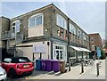
Cambridge Cookery School & Cafe
See Image for a similar view of the building taken 14 years earlier.
Image: © Fernweh
Taken: 17 Apr 2022
0.02 miles
8
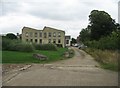
Gardens & Office Block
The Michael Young Centre.
UPDATE 2022: This building was demolished quite a few years ago and the site is now a residential block known as Homerton Gardens.
Image: © Mr Ignavy
Taken: 27 Aug 2008
0.02 miles
9
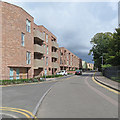
The Magna housing development, Harrison Drive
Magna is a housing project by Homerton College and the developers Hill, on land between the college (right) and the railway.
Image: © John Sutton
Taken: 17 Sep 2017
0.02 miles
10
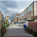
Homerton Gardens and Cambridge Cookery School
The school, which includes a café, is part of the National Extension College, and is housed in a building once occupied by Rattee & Kett, the celebrated Cambridge builders and stonemasons. The tower taking shape in the distance on the left, on the other side of the railway, is part of The Triangle, new offices for Cambridge Assessment.
Image: © John Sutton
Taken: 17 Sep 2017
0.03 miles