IMAGES TAKEN NEAR TO
Swavesey Road, CAMBRIDGE, CB24 4SE
Introduction
This page details the photographs taken nearby to Swavesey Road, CB24 4SE by members of the Geograph project.
The Geograph project started in 2005 with the aim of publishing, organising and preserving representative images for every square kilometre of Great Britain, Ireland and the Isle of Man.

There are currently over 7.5m images from over14,400 individuals and you can help contribute to the project by visiting https://www.geograph.org.uk
Image Map
Images are licensed for reuse under creativecommons.org/licenses/by-sa/2.0
Notes
- Clicking on the map will re-center to the selected point.
- The higher the marker number, the further away the image location is from the centre of the postcode.
Image Listing (26 Images Found)
Images are licensed for reuse under creativecommons.org/licenses/by-sa/2.0
Image
Details
Distance
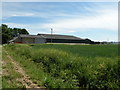
3
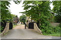
St John's College Farm
The university colleges have a significant landholding presence around Cambridge. Even land is sold, it normally has a clause that it has to be offered to the university or college first when it is sold again.
Image: © Hugh Venables
Taken: 23 May 2012
0.02 miles
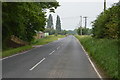
5
College Farm
The signs on the farm do not mention the "St John's" portion of the name as shown on the OS map
Image: © Keith Edkins
Taken: 6 Jun 2014
0.03 miles
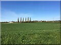
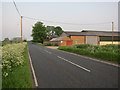
10
Buildings at College Farm
Described as Poultry Houses on large scale maps
Image: © Keith Edkins
Taken: 6 Jun 2014
0.14 miles