
IMAGES TAKEN NEAR TO
Sheepwash Way, CAMBRIDGE, CB24 3GZ
Introduction
This page details the photographs taken nearby to Sheepwash Way, CB24 3GZ by members of the Geograph project.
The Geograph project started in 2005 with the aim of publishing, organising and preserving representative images for every square kilometre of Great Britain, Ireland and the Isle of Man.

There are currently over 7.5m images from over14,400 individuals and you can help contribute to the project by visiting https://www.geograph.org.uk
Image Map
Images are licensed for reuse under creativecommons.org/licenses/by-sa/2.0
Notes
- Clicking on the map will re-center to the selected point.
- The higher the marker number, the further away the image location is from the centre of the postcode.
Image Listing (92 Images Found)
Images are licensed for reuse under creativecommons.org/licenses/by-sa/2.0
Image
Details
Distance
1
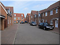
Sheepwash Way, Longstanton
Large and still expanding area of new housing on the edge of the village. Front gardens don't seem to feature in these new developments and the fact that house owners own one or two cars seems to be a surprise to the designers. The partial solution in this area is to have a fairly lax concept of pavements, which solves the parking problem but means you sometimes have to walk in the road. I wouldn't want to try to get round in a wheelchair or even with a buggy.
Image: © Hugh Venables
Taken: 3 Mar 2012
0.03 miles
2
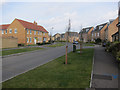
Stevenson Road, Longstanton
Part of the large area of new housing on the edge of the village.
Image: © Hugh Venables
Taken: 3 Mar 2012
0.06 miles
3
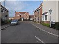
Bullen Close leading to Collingwood Drive
If the people naming the roads knew a bit more about the English language then this may have been Bullen Road rather than Bullen Close and if they knew a bit more about the England cricket team the other road may have been Collingwood Nurdle. The roads are actually named after captains from the Battle of Trafalgar.
Image: © Hugh Venables
Taken: 3 Mar 2012
0.07 miles
4
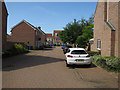
Collingwood Drive, Longstanton
Driving is OK in Longstanton, it's the parking that's the problem.
Image: © Hugh Venables
Taken: 4 Jul 2015
0.08 miles
5
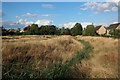
Open area in the new part of Longstanton
Image: © Hugh Venables
Taken: 5 Aug 2022
0.09 miles
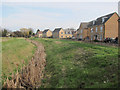
7
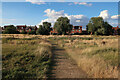
Open area in the new part of Longstanton
Image: © Hugh Venables
Taken: 5 Aug 2022
0.10 miles
8
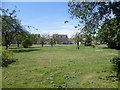
Green at Nelson Crescent, Longstanton
The housing in Nelson Crescent bordering this green has only recently been built. It is seen here from High Street.
Image: © Marathon
Taken: 3 May 2013
0.10 miles
9
Building on Over Road
Marked as a depot on the map.
Image: © Hugh Venables
Taken: 1 Nov 2014
0.10 miles
10
Open area in Longstanton
Looking from one new area of housing to another across a grassy field. This is a public footpath but the sign is missing from the pole.
Image: © Hugh Venables
Taken: 3 Mar 2012
0.10 miles