1
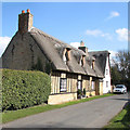
Magdalene College Cottage, St Michael's Lane, Longstanton
A Grade II listed building dating back to the late C17th, see https://britishlistedbuildings.co.uk/101127297-magdalene-college-cottage-longstanton#.YT-Ehn3TXIU
Image: © Martin Tester
Taken: 11 Sep 2021
0.01 miles
2
Cottages by St Michael's Churchyard, Longstanton
St Michael's Church is maintained by the Churches Conservation Trust (formerly the Redundant Churches Fund) as there is another church in Longstanton in the form of All Saints - see http://www.geograph.org.uk/photo/3445071 . In front of the cottages in St Michael's Lane can be seen St Michael's Well in the churchyard. This dates from medieval times and was formerly used for baptism - see also http://www.geograph.org.uk/photo/3445081
For an excellent series of photographs of St Michael's see https://www.flickr.com/photos/norfolkodyssey/sets/72157650576373025/
Image: © Marathon
Taken: 3 May 2013
0.01 miles
3
K6 phone box in St Michael's, Longstanton
Image: © Keith Edkins
Taken: 30 Jul 2008
0.02 miles
4
Longstanton: Magdalene College Cottage
The Grade II listing begins "Cottage: late C17, and possibly C18. Late C18 and mid C20 alterations. Timber-framed with mid-C20 brick infill, part weatherboarded. Crosswing rendered".
Image: © John Sutton
Taken: 19 Mar 2021
0.02 miles
5
Longstanton: thatched house in St Michael's Lane
A sunny morning in early April.
Image: © John Sutton
Taken: 2 Apr 2013
0.02 miles
6
St Michael's Lane, Longstanton
An early summer view compared with an early spring shot in 2007
Image
Image: © Michael Trolove
Taken: 18 May 2011
0.02 miles
7
Thatched house by St Michael's churchyard
St Michael's Well sits in the front of the churchyard.
Image: © Bill Boaden
Taken: 30 Jan 2015
0.03 miles
8
St Michael's Lane, Longstanton, Cambridgeshire
Image: © Keith Edkins
Taken: 9 Mar 2007
0.03 miles
9
St Michael's Well, Longstanton
The church of St Michael's is Grade II* listed (https://britishlistedbuildings.co.uk/101127298-church-of-st-michael-longstanton#.YUXEHn3TXIV ) but this well, of medieval origins, is Grade II listed separately, see: https://britishlistedbuildings.co.uk/101164289-well-and-wellhead-churchyard-church-of-st-michael-longstanton#.YUXDSX3TXIU
Image: © Martin Tester
Taken: 11 Sep 2021
0.03 miles
10
St Michael's Lane, Longstanton
Thatched cottages along the lane.
Image: © Hugh Venables
Taken: 9 May 2009
0.03 miles


