
IMAGES TAKEN NEAR TO
Flude Way, CAMBRIDGE, CB24 1DG
Introduction
This page details the photographs taken nearby to Flude Way, CB24 1DG by members of the Geograph project.
The Geograph project started in 2005 with the aim of publishing, organising and preserving representative images for every square kilometre of Great Britain, Ireland and the Isle of Man.

There are currently over 7.5m images from over14,400 individuals and you can help contribute to the project by visiting https://www.geograph.org.uk
Image Map
Images are licensed for reuse under creativecommons.org/licenses/by-sa/2.0
Notes
- Clicking on the map will re-center to the selected point.
- The higher the marker number, the further away the image location is from the centre of the postcode.
Image Listing (220 Images Found)
Images are licensed for reuse under creativecommons.org/licenses/by-sa/2.0
Image
Details
Distance

2

Bovis plot, Northstowe
To be Flude Way.
Image: © Hugh Venables
Taken: 12 Jan 2019
0.02 miles
3
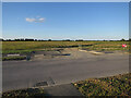
Bovis site to be
Part of Phase 1 of the new town. The pre-development fallow was a surprisingly good wildlife habitat.
Image: © Hugh Venables
Taken: 21 Jun 2018
0.03 miles
4
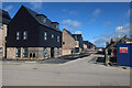
Britannia Road, Northstowe
One of many house building parcels in the new town, this one by Bovis.
Image: © Hugh Venables
Taken: 12 Mar 2020
0.03 miles
5

Earthworks for Northstowe
Bovis site just starting near the Park & Ride.
Image: © Hugh Venables
Taken: 12 Jan 2019
0.03 miles
6
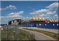
Bovis plot by Stirling Road, Northstowe
Work restarting after a pause at the start of the pandemic.
Image: © Hugh Venables
Taken: 1 Jun 2020
0.04 miles
7
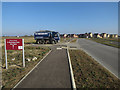
Stirling Road, Northstowe
Looking towards the Linden site.
Image: © Hugh Venables
Taken: 10 Oct 2018
0.04 miles
8

Stirling Road, Northstowe
With a parcel of Bovis houses under development.
Image: © Hugh Venables
Taken: 7 Jan 2021
0.04 miles
9
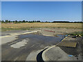
Bovis site to be
Part of Phase 1 of Northstowe.
Image: © Hugh Venables
Taken: 3 Aug 2018
0.04 miles
10
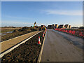
Stirling Road, Northstowe
Looking towards the Linden site. The road is named after the bombers that flew from Oakington Airfield during WWII. This part of Northstowe is mostly on the site of the Cambridge Golf Club course, but most of the new town will be on the airfield site.
Image: © Hugh Venables
Taken: 18 Dec 2017
0.04 miles