
IMAGES TAKEN NEAR TO
Britannia Road, CAMBRIDGE, CB24 1DD
Introduction
This page details the photographs taken nearby to Britannia Road, CB24 1DD by members of the Geograph project.
The Geograph project started in 2005 with the aim of publishing, organising and preserving representative images for every square kilometre of Great Britain, Ireland and the Isle of Man.

There are currently over 7.5m images from over14,400 individuals and you can help contribute to the project by visiting https://www.geograph.org.uk
Image Map
Images are licensed for reuse under creativecommons.org/licenses/by-sa/2.0
Notes
- Clicking on the map will re-center to the selected point.
- The higher the marker number, the further away the image location is from the centre of the postcode.
Image Listing (216 Images Found)
Images are licensed for reuse under creativecommons.org/licenses/by-sa/2.0
Image
Details
Distance
1
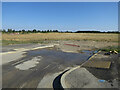
Bovis site to be
Part of Phase 1 of Northstowe.
Image: © Hugh Venables
Taken: 3 Aug 2018
0.03 miles
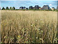
3
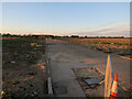
To be the bus route
Almost linking with the Park & Ride, but still a fence in the way. The final Northstowe plans are sensible, but little thought was put in to the situation before then. With the site as big as it is, this means hassle and difficult cycling for years.
Image: © Hugh Venables
Taken: 22 Apr 2018
0.04 miles
4
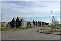
New housing by the Busway at Northstowe
Seen from the platform of the Guided Busway stop. Since John Sutton's very similar photo of last August (Image) this development has now been completed & occupied. On the right is the end of the extensive car park that allow this stop to be advertised as 'Park & Ride'.
Image: © Martin Tester
Taken: 26 Apr 2021
0.05 miles
5
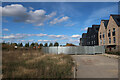
Bike and bus route through Northstowe
With work starting to connect it to the Park and Ride. It will run through the middle of the new town and connect back to the main busway track near Oakington.
Image: © Hugh Venables
Taken: 16 Oct 2022
0.05 miles
6
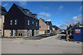
Britannia Road, Northstowe
One of many house building parcels in the new town, this one by Bovis.
Image: © Hugh Venables
Taken: 12 Mar 2020
0.05 miles
7

Earthworks for Northstowe
Bovis site just starting near the Park & Ride.
Image: © Hugh Venables
Taken: 12 Jan 2019
0.05 miles
8

Waterpark paths from Park & Ride
Not yet connected together.
Image: © Hugh Venables
Taken: 7 Jan 2021
0.06 miles
9
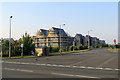
New houses at Northstowe
Northstowe new town is being built on the former RAF Oakington. The Cambridgeshire Guided Busway skirts the northern edge of the development and this photograph was taken early on an August morning from the cycle path next to the busway at the Longstanton Park & Ride busway stop.
Image: © John Sutton
Taken: 12 Aug 2020
0.06 miles
10
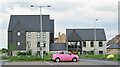
Longstanton - Park & Ride
Parking facility for travellers on the Cambridgeshire Guided Busway. This stretch connects St Ives with Cambridge and will be increasingly used by inhabitants of Northstowe which is under rapid housing development (2021).
www.thebusway.info
Image: © Colin Smith
Taken: 6 Jun 2021
0.06 miles