
IMAGES TAKEN NEAR TO
Parr Close, CAMBRIDGE, CB24 1DB
Introduction
This page details the photographs taken nearby to Parr Close, CB24 1DB by members of the Geograph project.
The Geograph project started in 2005 with the aim of publishing, organising and preserving representative images for every square kilometre of Great Britain, Ireland and the Isle of Man.

There are currently over 7.5m images from over14,400 individuals and you can help contribute to the project by visiting https://www.geograph.org.uk
Image Map
Images are licensed for reuse under creativecommons.org/licenses/by-sa/2.0
Notes
- Clicking on the map will re-center to the selected point.
- The higher the marker number, the further away the image location is from the centre of the postcode.
Image Listing (198 Images Found)
Images are licensed for reuse under creativecommons.org/licenses/by-sa/2.0
Image
Details
Distance
1
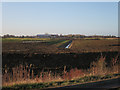
New ditch on Northstowe site
Looking towards the new primary school. Next some houses, finally.
Image: © Hugh Venables
Taken: 23 Dec 2015
0.02 miles
2
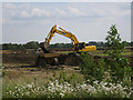
Earth moving for Northstowe
The first phase of Northstowe involves building on the former Cambridge Golf Course and neighbouring land. Earth is being moved to prepare for the works and probably reduce flood risk in lower areas.
Image: © Hugh Venables
Taken: 18 Jun 2015
0.04 miles
3
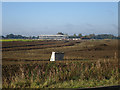
Northstowe work continuing
More earth moving and the start of building of the primary school.
Image: © Hugh Venables
Taken: 19 Sep 2015
0.04 miles
5
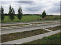
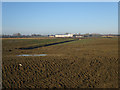
Cambridge Golf Club
View of an inflating hot air balloon about to launch from the golf course. This may soon be the first phase of Northstowe.
Image: © Hugh Venables
Taken: 23 Aug 2012
0.05 miles
6
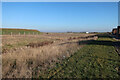
Ditch by Linden site, Northstowe
With developing fallow vegetation before landscaping and tidying.
Image: © Hugh Venables
Taken: 6 Feb 2020
0.05 miles
7
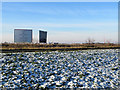
'Things are happening at Northstowe'
Phase 1 of the new town development is at the Longstanton end of a large site which includes the former RAF Oakington (later Oakington Barracks) and the roofs of some of the first houses show on the low skyline in this view taken from the cycle track beside the guided busway on a bright December morning.
Image: © John Sutton
Taken: 12 Dec 2017
0.06 miles
8
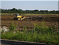
Earth moving for Northstowe
The first phase of Northstowe involves building on the former Cambridge Golf Course. Earth is being moved to prepare for the works and probably reduce flood risk in lower areas.
Image: © Hugh Venables
Taken: 11 Jun 2015
0.06 miles

10

Northern Greenway and Bovis parcel, Northstowe
With a bus on the guided busway.
Image: © Hugh Venables
Taken: 13 Mar 2020
0.06 miles