
IMAGES TAKEN NEAR TO
Huntingdon Road, CAMBRIDGE, CB23 8DW
Introduction
This page details the photographs taken nearby to Huntingdon Road, CB23 8DW by members of the Geograph project.
The Geograph project started in 2005 with the aim of publishing, organising and preserving representative images for every square kilometre of Great Britain, Ireland and the Isle of Man.

There are currently over 7.5m images from over14,400 individuals and you can help contribute to the project by visiting https://www.geograph.org.uk
Image Map
Images are licensed for reuse under creativecommons.org/licenses/by-sa/2.0
Notes
- Clicking on the map will re-center to the selected point.
- The higher the marker number, the further away the image location is from the centre of the postcode.
Image Listing (25 Images Found)
Images are licensed for reuse under creativecommons.org/licenses/by-sa/2.0
Image
Details
Distance
1
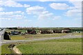
Hill Farm Cottages, Lolworth
The photograph is taken from the new bridge taking Robins' Lane to Lolworth over both the A14 & the parallel A1307. The long length of shadow alongside the A1307 is thrown by a c12ft high acoustic barrier shielding the residents from the roar of the A14 traffic just about visible on the extreme left beyond the A1307.
Image: © Martin Tester
Taken: 13 Apr 2021
0.01 miles
2
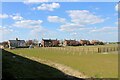
Hill Farm Cottages, Lolworth
The photograph is taken from alongside the A1307. The long length of shadow is thrown by a c12ft high acoustic barrier shielding the residents from the roar of the A14 traffic which runs alongside the A1307. The pair of cottages on the extreme left are shown on the 1892 OS 25 inch map. The next 3 pairs appear on the 1949 OS 1:10,560 map. This suggests the fourth pair, on the extreme right, was built post-war - it certainly differs in some respects from the others.
Image: © Martin Tester
Taken: 13 Apr 2021
0.02 miles
3
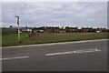
Hill Farm Cottages
From the new bridge to Lolworth.
Image: © Hugh Venables
Taken: 24 Oct 2020
0.02 miles
4
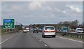
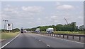
A14 Half mile to Cambridge Services
Heading north west.
Image: © Julian P Guffogg
Taken: 4 May 2013
0.07 miles
6
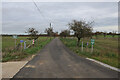
Track to Hill Farm
Now accessed via the local access road and road to Lolworth, rather than a turn directly off the A14.
Image: © Hugh Venables
Taken: 24 Oct 2020
0.08 miles
7
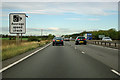
A14 average speed check sign
Because of the traffic on this section it would be quite a challenge to exceed the speed limit on average at most times of day.
Image: © Robin Webster
Taken: 7 Oct 2011
0.09 miles
8
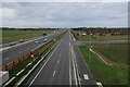
A14 and A1307 near Lolworth
From the new bridge to Lolworth. With the A14 upgraded to (near) motorway standards the old junction for Lolworth was no longer suitable, see Image
Image: © Hugh Venables
Taken: 24 Oct 2020
0.10 miles
9
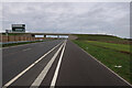
New bridge to Lolworth
With the A14 widened and upgraded to (near) motorway standards, smaller junctions and cyclists are now served by the local access road. Definitely an improvement for cycling and you can now turn right out of Lolworth. See Image for the old junction that only connected to the westbound carriageway of the A14.
Image: © Hugh Venables
Taken: 24 Oct 2020
0.14 miles
10
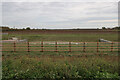
Drainage pool by A1307
One of many along the widened A14 and new local access road.
Image: © Hugh Venables
Taken: 24 Oct 2020
0.14 miles