IMAGES TAKEN NEAR TO
Cambridge Road, CAMBRIDGE, CB23 3PH
Introduction
This page details the photographs taken nearby to Cambridge Road, CB23 3PH by members of the Geograph project.
The Geograph project started in 2005 with the aim of publishing, organising and preserving representative images for every square kilometre of Great Britain, Ireland and the Isle of Man.

There are currently over 7.5m images from over14,400 individuals and you can help contribute to the project by visiting https://www.geograph.org.uk
Image Map
Images are licensed for reuse under creativecommons.org/licenses/by-sa/2.0
Notes
- Clicking on the map will re-center to the selected point.
- The higher the marker number, the further away the image location is from the centre of the postcode.
Image Listing (15 Images Found)
Images are licensed for reuse under creativecommons.org/licenses/by-sa/2.0
Image
Details
Distance
1
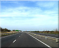
A428 St.Neots Road, Cambourne
Approaching the junction with the A1198 Ermine Street South
Image: © Geographer
Taken: 29 Mar 2014
0.06 miles
2
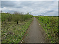
Path to A1198
Along the dualled A428 along the section without the old road.
Image: © Hugh Venables
Taken: 2 Apr 2017
0.09 miles
3
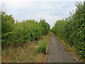
Path to Caxton Gibbet
This path runs parallel to the A428 from the Cambourne to Elsworth road (a little behind the camera) to Caxton Gibbet.
Image: © John Sutton
Taken: 2 Sep 2022
0.10 miles
4
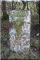
Old Milepost by the former A428, west of Cambourne
Cast iron post by the UC road (was A428), in parish of Caxton (South Cambridgeshire District), East of Oak Tree Cottage, at Western end of Cambourne dual carriageway, on the verge, on South side of road. St Neot iron casting, erected by the St Neots to Cambridge turnpike trust in the 19th century.
Inscription reads:-
: ST NEOTS / 8 : : ELSWORTH / --- / OXFORD / 77 : : CAMBRIDGE / 10 :
Grade II listed.
List Entry Number: 1331369 https://historicengland.org.uk/listing/the-list/list-entry/1331369
Milestone Society National ID: CA_CASN10
Image: © MW Hallett
Taken: 25 May 2003
0.11 miles
5
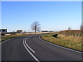
Brockley Road & footpath to Ermine Street South
Image: © Geographer
Taken: 2 Dec 2012
0.14 miles
6
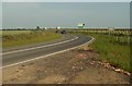
The road that links Elsworth with Cambourne
Image: © Robert Edwards
Taken: 8 Jun 2007
0.15 miles
7
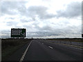
A428 Cambridge Road, Caxton Gibbet
Approaching the junction with St.Neots Road
Image: © Geographer
Taken: 16 Dec 2013
0.16 miles
8
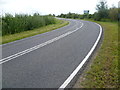
The road to Cambourne
This is the view of the road which parallels the dual carriageway of the A428, just as it goes through a right-angled bend on its way from Elsworth to Cambourne. The road sign belongs to the A428 and is signifying the turn-off for Cambourne, Elsworth and Boxworth
Image: © Marathon
Taken: 14 Aug 2014
0.16 miles