
IMAGES TAKEN NEAR TO
Baldwins Close, CAMBRIDGE, CB23 2TH
Introduction
This page details the photographs taken nearby to Baldwins Close, CB23 2TH by members of the Geograph project.
The Geograph project started in 2005 with the aim of publishing, organising and preserving representative images for every square kilometre of Great Britain, Ireland and the Isle of Man.

There are currently over 7.5m images from over14,400 individuals and you can help contribute to the project by visiting https://www.geograph.org.uk
Image Map
Images are licensed for reuse under creativecommons.org/licenses/by-sa/2.0
Notes
- Clicking on the map will re-center to the selected point.
- The higher the marker number, the further away the image location is from the centre of the postcode.
Image Listing (100 Images Found)
Images are licensed for reuse under creativecommons.org/licenses/by-sa/2.0
Image
Details
Distance
1
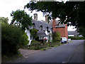
Malvern Cottage, Riddy Lane
Possibly late C17. Timber-framed with rough cast render, thatched roof. Gault brick ridge stack and end stack to right hand. Thatched open porch. Grade II listed, LBS Number: 51072. http://www.heritagegateway.org.uk/Gateway/Results_Single.aspx?resourceID=5&uid=51072
Image: © Keith Edkins
Taken: 4 Jul 2008
0.02 miles
2

Bourn: Riddy Lane
Part of Home Farm is on the right. According to the Grade II listing the four-dormered thatched house may date from the late 17th century.
Image: © John Sutton
Taken: 26 Feb 2021
0.02 miles
3
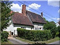
King Alfred's House, Riddy Lane
You cannot be serious!
Image: © Keith Edkins
Taken: 4 Jul 2008
0.03 miles
4
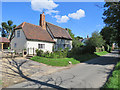
Bourn: King Alfred's House, Riddy Lane
South Cambridgeshire is a long way from Wessex. The Grade II listing begins "Possibly c.1616 or earlier and C18. Exposed and plastered timber frame, thatched and plain tile roofs".
Image: © John Sutton
Taken: 1 Sep 2020
0.03 miles
5

Bourn: four dormers on Riddy Lane
Two of a good number of Grade II listed buildings in the village. The brick house on the corner was once a public house.
Image: © John Sutton
Taken: 1 Jan 2022
0.03 miles
6
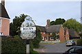
Bourn village sign and Home Farm across the road
For more about the village sign see https://www.geograph.org.uk/photo/6497806
Image: © Adrian S Pye
Taken: 4 Jun 2020
0.04 miles

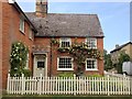
9

Bourn village sign
The only reference to the fact that in the Second World War there was an airfield at Bourn is the illustration of a Lancaster bomber on the village sign.
It was constructed for RAF Bomber Command in 1940 as a satellite airfield for nearby RAF Oakington.
The Lancaster featured on the sign is 97 Sqdn Lancaster JB659 OF-J.
On 30/01/1944 it had departed Bourn for a raid on Berlin, but was intercepted by a German night-fighter captained by Nacht-Jagd “Experten” Maj Heinz-Wolfgang Schnaufer and shot down. The aircraft crashed onto a farmhouse on the border of Amsterdam killing not only the crew of seven but six members of the Van der Bijl family in the farmhouse.
Image: © Adrian S Pye
Taken: 4 Jun 2020
0.04 miles
10
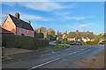
Bourn: winter sunlight
December 2021 was the drabbest on record, so it was good to see the sun on the morning of New Year's Day. The black car is turning from Alms Hill in to Caxton End (ahead, left of centre) or Riddy Lane (out of sight to the left).
Image: © John Sutton
Taken: 1 Jan 2022
0.04 miles