
IMAGES TAKEN NEAR TO
Comberton Road, CAMBRIDGE, CB23 2RY
Introduction
This page details the photographs taken nearby to Comberton Road, CB23 2RY by members of the Geograph project.
The Geograph project started in 2005 with the aim of publishing, organising and preserving representative images for every square kilometre of Great Britain, Ireland and the Isle of Man.

There are currently over 7.5m images from over14,400 individuals and you can help contribute to the project by visiting https://www.geograph.org.uk
Image Map
Images are licensed for reuse under creativecommons.org/licenses/by-sa/2.0
Notes
- Clicking on the map will re-center to the selected point.
- The higher the marker number, the further away the image location is from the centre of the postcode.
Image Listing (161 Images Found)
Images are licensed for reuse under creativecommons.org/licenses/by-sa/2.0
Image
Details
Distance
2
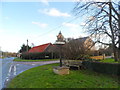
Toft village sign
On the corner of Comberton Road and Church Road
Image: © Bikeboy
Taken: 2 Jan 2014
0.03 miles
4
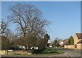
Toft: the corner of Church Road
On a bright morning in early spring.
Image: © John Sutton
Taken: 11 Mar 2012
0.03 miles
5
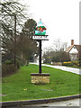
Toft Village sign
On the B1046 Comberton Road at the junction with Church Road
Image: © Geographer
Taken: 13 Dec 2015
0.03 miles
6
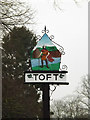
Toft Village sign
On the B1046 Comberton Road at the junction with Church Road
(Close up)
Image: © Geographer
Taken: 13 Dec 2015
0.03 miles
8
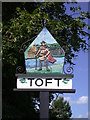
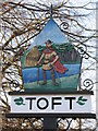
Toft Village Sign (east side)
Erected by the people of Toft village to celebrate the Silver Jubilee of Her Majesty Queen Elizabeth II 1952-1977
THE NORSEMAN
"A thousand years ago a man such as he was the true founder of our village. Laying aside his weapons he cleared land of scrub and trees and built himself a homestead - a TOFT." -- information plaque
Image: © Keith Edkins
Taken: 4 Jul 2008
0.04 miles
9
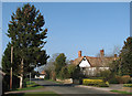
Toft: main street and Manor Farm
The 16th/17th-century former farmhouse on the right is Grade II listed - see http://www.britishlistedbuildings.co.uk/en-51191-manor-farmhouse-15-toft
Image: © John Sutton
Taken: 11 Mar 2012
0.04 miles
10

Toft village sign (west side)
This side depicts John Bunyon preaching in the village in 1659. Compare to the 2008 picture http://www.geograph.org.uk/photo/878633. The paint has faded and needs touching up. See http://www.geograph.org.uk/photo/662086 for the picture on the other side.
Image: © Bikeboy
Taken: 2 Jan 2014
0.04 miles