
IMAGES TAKEN NEAR TO
Fowlmere Road, CAMBRIDGE, CB22 7PG
Introduction
This page details the photographs taken nearby to Fowlmere Road, CB22 7PG by members of the Geograph project.
The Geograph project started in 2005 with the aim of publishing, organising and preserving representative images for every square kilometre of Great Britain, Ireland and the Isle of Man.

There are currently over 7.5m images from over14,400 individuals and you can help contribute to the project by visiting https://www.geograph.org.uk
Image Map
Images are licensed for reuse under creativecommons.org/licenses/by-sa/2.0
Notes
- Clicking on the map will re-center to the selected point.
- The higher the marker number, the further away the image location is from the centre of the postcode.
Image Listing (104 Images Found)
Images are licensed for reuse under creativecommons.org/licenses/by-sa/2.0
Image
Details
Distance
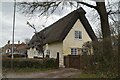
2
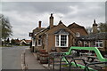
The Queens Head
An excellent pub, which has been in every edition of the Good Beer Guide.
Image: © N Chadwick
Taken: 5 Mar 2023
0.01 miles
3
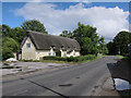
Thatched Cottage, Newton
With a lick of paint since Image
Image: © Hugh Venables
Taken: 16 Jul 2011
0.01 miles
4
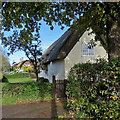
Newton: Deep Thatch and The Queen's Head
Deep Thatch has clunch walls. Wikipedia defines clunch as "generically a soft limestone. It can be rich in iron-bearing clays or be very fine and white - in effect just chalk. It is used in various parts of East Anglia, where more durable stone is uncommon". The Grade II listed house was built in the 18th century as three cottages.
Image: © John Sutton
Taken: 28 Oct 2018
0.01 miles
5
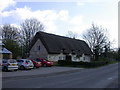
Deep Thatch, Fowlmere Road
That's what it claims to be called! For some reason it has the Prince of Wales' Feathers and motto "Ich Dien" on the end wall.
Image: © Keith Edkins
Taken: 3 Apr 2008
0.01 miles
6
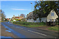
Newton: Deep Thatch, Fowlmere Road
Deep Thatch, on the right, next to The Queen's Head, has clunch walls. Wikipedia defines clunch as "generically a soft limestone. It can be rich in iron-bearing clays or be very fine and white - in effect just chalk. It is used in various parts of East Anglia, where more durable stone is uncommon".
Image: © John Sutton
Taken: 28 Oct 2018
0.01 miles
7
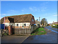
Newton: clunch walls at Top Farm Barn
Fowlmere Road, just south of the five-way crossroads at the centre of the village. Wikipedia defines clunch as "generically a soft limestone. It can be rich in iron-bearing clays or be very fine and white - in effect just chalk. It is used in various parts of East Anglia, where more durable stone is uncommon".
Image: © John Sutton
Taken: 28 Oct 2018
0.02 miles
8
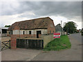
Top Barn, Fowlmere Road
On the edge of Newton.
Image: © Hugh Venables
Taken: 7 Jul 2014
0.02 miles
9
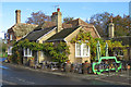
Newton: The Queen's Head from Fowlmere Road
The pub, which stands at the five-way crossroads in the middle of the village, is Grade II listed and dates from the first half of the 18th century (the yellow-brick parts are later additions). The pleasing tiled roof has recently been carefully restored - Image] shows the work in progress. Image] is a comparable picture, taken in 2014, before the vivid green car park symbol and associated bike rails were added.
Image: © John Sutton
Taken: 28 Oct 2018
0.02 miles
10
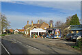
Newton: fish and chips at The Queen's Head
Fish and chips was a Sunday-lunch option in Newton as the Pimp My Fish van ("No ordinary fish & chip van!" according to its website) was parked in the pub car park in the centre of the village. The Queen's Head had a temporary sign after roof restoration in 2018 (see Image], taken earlier in 2020), but Anne of Cleves has now returned.
Image: © John Sutton
Taken: 22 Nov 2020
0.02 miles