
IMAGES TAKEN NEAR TO
Pampisford Road, CAMBRIDGE, CB21 6AQ
Introduction
This page details the photographs taken nearby to Pampisford Road, CB21 6AQ by members of the Geograph project.
The Geograph project started in 2005 with the aim of publishing, organising and preserving representative images for every square kilometre of Great Britain, Ireland and the Isle of Man.

There are currently over 7.5m images from over14,400 individuals and you can help contribute to the project by visiting https://www.geograph.org.uk
Image Map
Images are licensed for reuse under creativecommons.org/licenses/by-sa/2.0
Notes
- Clicking on the map will re-center to the selected point.
- The higher the marker number, the further away the image location is from the centre of the postcode.
Image Listing (18 Images Found)
Images are licensed for reuse under creativecommons.org/licenses/by-sa/2.0
Image
Details
Distance
1
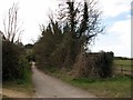
The start of a path to Great Chesterford
The Abington end of a path over the hills.
Image: © John Sutton
Taken: 16 Apr 2012
0.05 miles
2
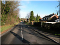
Great Abington High Street
The southern end
Image: © Keith Edkins
Taken: 26 Nov 2009
0.06 miles
3
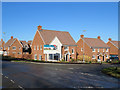
Great Abington: new houses
Red brick on the corner of Pampisford Road and High Street. An estate of unaffordable four-, five- and six-bedroom houses is unlikely to alleviate the nation's housing crisis.
Image: © John Sutton
Taken: 15 Feb 2018
0.06 miles
4
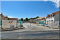
Great Abington: new houses off Pampisford Road
The site was still on a bright Sunday morning in July.
Image: © John Sutton
Taken: 24 Jul 2022
0.06 miles
5
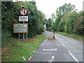
Entering Great Abington
Entering Great Abington, Cambridgeshire.
Image: © Keith Evans
Taken: 20 Sep 2016
0.07 miles
7
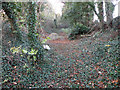
Track of old railway
The only trace hereabouts of the Cambridge-Haverhill line, closed in 1967, is this ivy-clad valley
Image: © Keith Edkins
Taken: 26 Nov 2009
0.12 miles
8
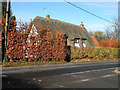
The Old Farm, High Street
C15 with mid C16 insertions and C17 addition. Timber-framed and plastered with exposed timber-frame in south gable. The farmhouse was converted into cottages in the C19 and restored in c.1930. Grade II listed, LBS Number: 51863. http://www.heritagegateway.org.uk/Gateway/Results_Single.aspx?uid=51863&resourceID=5
Image: © Keith Edkins
Taken: 26 Nov 2009
0.12 miles
9
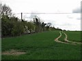
Traces of the Cambridge-Colchester railway
In this view east from the path from the Abingtons to Great Chesterford the line of trees on the left marks the trackbed of the Cambridge-Sudbury-Marks Tey Stour Valley Line, which closed in 1967.
Image: © John Sutton
Taken: 16 Apr 2012
0.13 miles
10
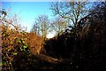
Abandoned railway cutting
The old Cambridge-Haverhill line seen from the Chalky Road crossing.
Image: © Tiger
Taken: 17 Feb 2008
0.13 miles