
IMAGES TAKEN NEAR TO
Gunhild Close, CAMBRIDGE, CB1 8RD
Introduction
This page details the photographs taken nearby to Gunhild Close, CB1 8RD by members of the Geograph project.
The Geograph project started in 2005 with the aim of publishing, organising and preserving representative images for every square kilometre of Great Britain, Ireland and the Isle of Man.

There are currently over 7.5m images from over14,400 individuals and you can help contribute to the project by visiting https://www.geograph.org.uk
Image Map
Images are licensed for reuse under creativecommons.org/licenses/by-sa/2.0
Notes
- Clicking on the map will re-center to the selected point.
- The higher the marker number, the further away the image location is from the centre of the postcode.
Image Listing (142 Images Found)
Images are licensed for reuse under creativecommons.org/licenses/by-sa/2.0
Image
Details
Distance
1
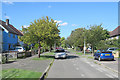
Gunhild Close
A post-war council estate on the south side of Cambridge.
Image: © John Sutton
Taken: 17 Aug 2017
0.02 miles
2
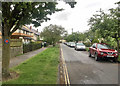
Gunhild Close on a wet afternoon
Part of a post-war council-built estate in the southern suburbs of Cambridge. During the coronavirus pandemic a knitted heart has been pinned to the tree on the left.
Image: © John Sutton
Taken: 10 May 2020
0.03 miles
3
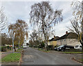
On Gunhild Way
Near the corner of Gunhild Close on a dreary Saturday in late November.
Image: © John Sutton
Taken: 26 Nov 2022
0.06 miles
4
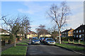
On Godwin Way
Looking towards Gunhild Way on a January morning.
Image: © John Sutton
Taken: 10 Jan 2016
0.06 miles
5
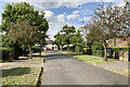
Late afternoon on Godwin Way
Many of the streets on this post-war estate in the Queen Edith's area of Cambridge have the names of Anglo-Saxon worthies.
Image: © John Sutton
Taken: 6 Jul 2023
0.06 miles
6
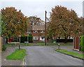
Strangeways Road and Godwin Way
On the grey first morning of October.
Image: © John Sutton
Taken: 1 Oct 2017
0.07 miles
7
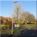
On Godwin Way
Council-built houses in one of the southern suburbs of Cambridge, photographed on a bright December afternoon. If you want streets named after famous Anglo-Saxons, this part of the city is the place to come.
Image: © John Sutton
Taken: 14 Dec 2019
0.08 miles
8
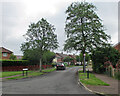
Up Spalding Way
A street in a council-built estate near the south-eastern edge of Cambridge.
Image: © John Sutton
Taken: 27 May 2021
0.08 miles
9
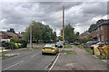
A stinkpipe on Godwin Way
Godwin Way is on the large post-war council-built estate between Cherry Hinton Road and Queen Edith's Way on the south side of Cambridge. This rusty sewer vent pipe is not on the 2013 blog-map which shows the majority of Cambridge stinkpipes (and some which have subsequently disappeared) - https://www.google.com/maps/d/viewer?mid=1tGa-vqWr8XI064h9UKIdCi-HU70&ll=52.20093555963424%2C0.1343196499999877&z=13 .
Image: © John Sutton
Taken: 25 Jul 2020
0.08 miles
10
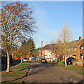
On Spalding Way
Suburban Cambridge on a bright November morning.
Image: © John Sutton
Taken: 18 Nov 2017
0.11 miles