IMAGES TAKEN NEAR TO
Perne Road, CAMBRIDGE, CB1 3RR
Introduction
This page details the photographs taken nearby to Perne Road, CB1 3RR by members of the Geograph project.
The Geograph project started in 2005 with the aim of publishing, organising and preserving representative images for every square kilometre of Great Britain, Ireland and the Isle of Man.

There are currently over 7.5m images from over14,400 individuals and you can help contribute to the project by visiting https://www.geograph.org.uk
Image Map
Images are licensed for reuse under creativecommons.org/licenses/by-sa/2.0
Notes
- Clicking on the map will re-center to the selected point.
- The higher the marker number, the further away the image location is from the centre of the postcode.
Image Listing (504 Images Found)
Images are licensed for reuse under creativecommons.org/licenses/by-sa/2.0
Image
Details
Distance
1
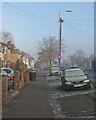
Perne Road on a December morning
Mist and a hard frost in the week after Christmas.
Image: © John Sutton
Taken: 28 Dec 2016
0.02 miles
3
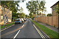
Perne Road on a cloudy July morning
Looking south from the corner of Langham Road. Perne Road is part of the A1134, Cambridge's inner ring road.
Image: © John Sutton
Taken: 24 Jul 2021
0.04 miles
4
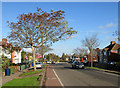
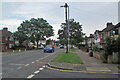
A fine November morning on Perne Road
The red sign warns of a new road layout ahead, at the Radegund Road roundabout, where the carriageway has been narrowed and a cycle path added to widened pavements (see Image]).
Image: © John Sutton
Taken: 10 Nov 2014
0.04 miles

7
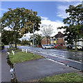
Perne Road after a downpour
A section of Cambridge's inner ring road, nearing the junction with Radegund Road and Birdwood Road. On a Sunday afternoon in late September there was less traffic than on a weekday.
Image: © John Sutton
Taken: 29 Sep 2019
0.05 miles
8
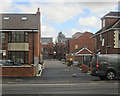
Perne Road: nearing completion
This is a development on garden land between Perne Road and Chalmers Road.
Earlier images:
Image] (November 2017)
Image] (March 2018)
Image] (July 2018)
Image] (October 2018)
Image] (November 2018)
Image] (December 2018)
Image] (April 2019)
Image] (May 2019)
Image: © John Sutton
Taken: 25 Sep 2019
0.06 miles
9
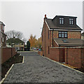
A new view towards Perne Road
Behind the camera houses have been built on garden land between Perne Road and Chalmers Road. This is the approach to them from Perne Road. On the right is the rear of the house shown in Image], taken at the start of this building project. The silver birches in the centre of the picture line Perne Avenue.
See Image] (September 2019), which has links to earlier phases of building.
Image: © John Sutton
Taken: 17 Nov 2019
0.06 miles