
IMAGES TAKEN NEAR TO
Morris Harp, SAFFRON WALDEN, CB10 2EE
Introduction
This page details the photographs taken nearby to Morris Harp, CB10 2EE by members of the Geograph project.
The Geograph project started in 2005 with the aim of publishing, organising and preserving representative images for every square kilometre of Great Britain, Ireland and the Isle of Man.

There are currently over 7.5m images from over14,400 individuals and you can help contribute to the project by visiting https://www.geograph.org.uk
Image Map
Images are licensed for reuse under creativecommons.org/licenses/by-sa/2.0
Notes
- Clicking on the map will re-center to the selected point.
- The higher the marker number, the further away the image location is from the centre of the postcode.
Image Listing (11 Images Found)
Images are licensed for reuse under creativecommons.org/licenses/by-sa/2.0
Image
Details
Distance
1
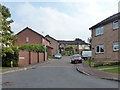
Doddenhill Close, Saffron Walden
In the comparatively recent residential expansion north of the old town.
Image: © Robin Webster
Taken: 3 Oct 2015
0.08 miles
3
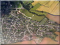
Saffron Walden from the air
The northern edge of the town, with the B1052 passing through. Two patches of allotments can be seen, and the playing ground of Saffron Walden Town FC [top left].
Image: © M J Richardson
Taken: 12 Jul 2017
0.16 miles
4
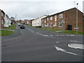
Goddard Way
Mid-1970s estate off Little Walden Road
Image: © Keith Edkins
Taken: 29 Nov 2017
0.16 miles
5
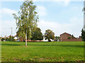
The Green, Saffron Walden
A fairly modern creation in the residential expansion north of the old town. This has houses on three sides and the main road, Little Walden Road, on the east side.
Image: © Robin Webster
Taken: 3 Oct 2015
0.20 miles
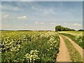
7
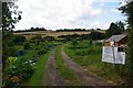
Saffron Walden Allotments
These allotments are just off of Image
Image: © Glyn Baker
Taken: 28 Aug 2009
0.20 miles
8
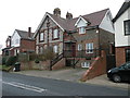
Flint-fronted house, Little Walden Road
Surely this has been refaced and reroofed, but the chimneys suggest this building is quite old. It is on the earliest available OS map in 1877.
Image: © Keith Edkins
Taken: 29 Nov 2017
0.21 miles
10
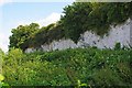
Limefield Pit Reserve
Limefield Pit was formerly known as Little Walden Rd Quarry. Most of the pit is now a housing estate see Image The area below the chalk cliff is a real nature reserve in that it is left to wildlife, no visiting is allowed beyond the perimeter fence, the site is managed by Essex Wildlife Trust http://www.essexwt.org.uk/ Continue on a virtual tour of Wildlife Trust Reserves in Essex
by visiting Image
Image: © Glyn Baker
Taken: 28 Aug 2009
0.23 miles