
IMAGES TAKEN NEAR TO
Eastgate, SAFFRON WALDEN, CB10 1PA
Introduction
This page details the photographs taken nearby to Eastgate, CB10 1PA by members of the Geograph project.
The Geograph project started in 2005 with the aim of publishing, organising and preserving representative images for every square kilometre of Great Britain, Ireland and the Isle of Man.

There are currently over 7.5m images from over14,400 individuals and you can help contribute to the project by visiting https://www.geograph.org.uk
Image Map
Images are licensed for reuse under creativecommons.org/licenses/by-sa/2.0
Notes
- Clicking on the map will re-center to the selected point.
- The higher the marker number, the further away the image location is from the centre of the postcode.
Image Listing (126 Images Found)
Images are licensed for reuse under creativecommons.org/licenses/by-sa/2.0
Image
Details
Distance
1
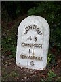
Old Milestone by the B1383, Market Road, Great Chesterford parish
Carved stone post by the B1383 (was A11), in parish of GREAT CHESTERFORD (UTTLESFORD District), by central road island, by the road, on West side of road. Erected by the Hockerill turnpike trust in the 19th century.
Inscription reads:-
LONDON
43
CAMBRIDGE
11
NEWMARKET
16
Carved bench mark and rivet on top.
Essex HER.
SMR Number: 15076 https://www.heritagegateway.org.uk/Gateway/Results_Single.aspx?uid=MEX40578&resourceID=1001
Milestone Society National ID: EX_BSGC43.
Image: © JV Nicholls
Taken: Unknown
0.02 miles
2
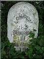
Old Milestone
Old milepost at Great Chesterford, Essex on part of what was the A.11. For overall view see http://www.geograph.org.uk/photo/1304766 For more info see http://milestones.megalithia.com/sites/tl505429.htm do look at their home page.
Image: © Keith Evans
Taken: 15 May 2009
0.02 miles
3
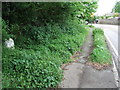
Old Milepost
Old milepost at Great Chesterford, Essex on what was the old A.11. For close up view see http://www.geograph.org.uk/photo/1304771 for info on the post see http://milestones.megalithia.com/sites/tl505429.htm do look at their home page.
Image: © Keith Evans
Taken: 15 May 2009
0.03 miles
4
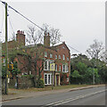
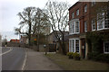
Great Chesterford: The Crown House
The front to the main road is rather grand, the ranges to the rear more vernacular, as Image] shows. The building dates from the 18th century and is Grade II listed. You don't see many of those old AA Hotel signs (bracketed to the electricity pole) these days.
Image: © John Sutton
Taken: 3 Nov 2021
0.03 miles
6
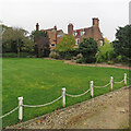
Great Chesterford: the rear of The Crown House
The front to the main road is rather grand, as Image] shows, the ranges to the rear more vernacular. The building dates from the 18th century and is Grade II listed.
Image: © John Sutton
Taken: 3 Nov 2021
0.05 miles
7

The Post Office in School Street at Great Chesterford
Image: © Robert Edwards
Taken: 21 Aug 2009
0.06 miles
8
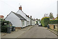
Great Chesterford: on Carmen Street
The white building on the left, once a bakery, is one of many Grade II listed timber-framed buildings in Carmen Street. It dates from the early part of the 19th century.
Image: © John Sutton
Taken: 3 Nov 2021
0.06 miles
10
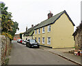
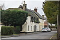
Great Chesterford: listed buildings on Carmen Street
There are many Grade II listed timber-framed houses in the village. The nearer one dates from the 19th century, the thatched one from the 17th.
Image: © John Sutton
Taken: 3 Nov 2021
0.07 miles