IMAGES TAKEN NEAR TO
The Courtyard, BRAMPTON, CA8 9LS
Introduction
This page details the photographs taken nearby to The Courtyard, CA8 9LS by members of the Geograph project.
The Geograph project started in 2005 with the aim of publishing, organising and preserving representative images for every square kilometre of Great Britain, Ireland and the Isle of Man.

There are currently over 7.5m images from over14,400 individuals and you can help contribute to the project by visiting https://www.geograph.org.uk
Image Map
Images are licensed for reuse under creativecommons.org/licenses/by-sa/2.0
Notes
- Clicking on the map will re-center to the selected point.
- The higher the marker number, the further away the image location is from the centre of the postcode.
Image Listing (26 Images Found)
Images are licensed for reuse under creativecommons.org/licenses/by-sa/2.0
Image
Details
Distance
1
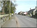
The B6413 through Castle Carrock
Taken from near the entrance to Image - the entrance to which can be seen on the left
Image: © John Baker
Taken: 24 Mar 2012
0.02 miles
2
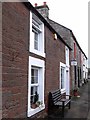
Village shop, Castle Carrock
A rare sight these days.
Image: © Oliver Dixon
Taken: 4 Apr 2009
0.03 miles
3
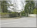
Gelt Hall, Castle Carrock
The hall, which stands beside the B6413, was built in 1863 by John Watson, the father of John Procter Watson who gave The Wilson Hall to the village.
Image: © John Baker
Taken: 24 Mar 2012
0.03 miles
4
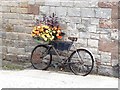
Bicycle as planter
By the wall of Castlegate Barn.
Image: © Oliver Dixon
Taken: 7 Aug 2020
0.05 miles
5
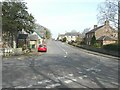
The B6413 through Castle Carrock
Taken from its junction with a minor road to Geltsdale (to the right) and Rectory Road (to the left)
Image: © John Baker
Taken: 24 Mar 2012
0.07 miles
6
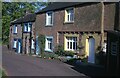
Castle Carrock
Clara Cottage featured here.
Image: © David M Clark
Taken: 19 Oct 1975
0.08 miles
7
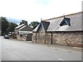
Gelt Hall Farm
In the middle of Castle Carrock village.
Image: © Oliver Dixon
Taken: 7 Aug 2020
0.09 miles
8
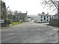
The green and Duke of Cumberland at Castle Carrock
The Duke of Cumberland public house is the building opposite the white-painted building, on the right hand side of the minor road, which is known as The Weary Sportsman. The truncated road sign points left to Brampton 4 (miles) along the B6413 (from where this view was taken) and right to Geltsdale.
Image: © John Baker
Taken: 24 Mar 2012
0.12 miles
9
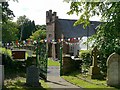
Watson Institute, Castle Carrock, viewed from churchyard
The bunting and marquee were part of village celebrations to mark the centenary of Castle Carrock reservoir being opened. A plaque above the door of the institute has a date of 1897. It was built as a public hall, free library and reading room by J.P. Watson http://www.stevebulman.f9.co.uk/cumbria/1901/castle_carrock_f.html .
Image: © Rose and Trev Clough
Taken: 11 Jul 2009
0.12 miles