IMAGES TAKEN NEAR TO
Gilsland, BRAMPTON, CA8 7DB
Introduction
This page details the photographs taken nearby to CA8 7DB by members of the Geograph project.
The Geograph project started in 2005 with the aim of publishing, organising and preserving representative images for every square kilometre of Great Britain, Ireland and the Isle of Man.

There are currently over 7.5m images from over14,400 individuals and you can help contribute to the project by visiting https://www.geograph.org.uk
Image Map
Images are licensed for reuse under creativecommons.org/licenses/by-sa/2.0
Notes
- Clicking on the map will re-center to the selected point.
- The higher the marker number, the further away the image location is from the centre of the postcode.
Image Listing (13 Images Found)
Images are licensed for reuse under creativecommons.org/licenses/by-sa/2.0
Image
Details
Distance
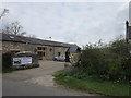
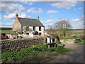
3
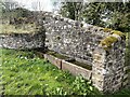
Drinking troughs
Fed by a spring that emerges from the rear wall. Excess water flows into the nearby Harrow's Beck.
Image: © Leanmeanmo
Taken: 1 May 2023
0.04 miles
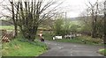
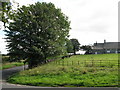
5
Farm road to Breckney Bed
Between Gilsland and Birdoswald
Image: © Oliver Dixon
Taken: 20 Jul 2006
0.08 miles
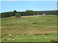
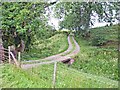
8
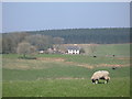
Midgeholme Moss (2)
Looking north towards Slack House (just over the grid line in Image) and the plantation on Waterhead Common.
Image: © Mike Quinn
Taken: 20 Apr 2009
0.13 miles