
IMAGES TAKEN NEAR TO
Low Row, BRAMPTON, CA8 2LU
Introduction
This page details the photographs taken nearby to CA8 2LU by members of the Geograph project.
The Geograph project started in 2005 with the aim of publishing, organising and preserving representative images for every square kilometre of Great Britain, Ireland and the Isle of Man.

There are currently over 7.5m images from over14,400 individuals and you can help contribute to the project by visiting https://www.geograph.org.uk
Image Map
Images are licensed for reuse under creativecommons.org/licenses/by-sa/2.0
Notes
- Clicking on the map will re-center to the selected point.
- The higher the marker number, the further away the image location is from the centre of the postcode.
Image Listing (9 Images Found)
Images are licensed for reuse under creativecommons.org/licenses/by-sa/2.0
Image
Details
Distance
3
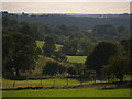
The Lane down to Nook and Wallholme
Image: © Clive Nicholson
Taken: 10 Aug 2006
0.12 miles
4
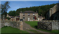
Nook
The house at Nook in the Irthing Valley. For an earlier image see Image] by Les Hull.
Image: © Peter McDermott
Taken: 12 Sep 2009
0.13 miles
6
Barn at Lane Head Farm
Ordnance Survey documents indicate that a benchmark levelled at 117.403m above Newlyn Datum was verified in 1955 on the left hand side of the building
Image: © Roger Templeman
Taken: 24 Apr 2023
0.22 miles
7
Barn at Lane Head Farm
Ordnance Survey documents indicate that a benchmark levelled at 117.403m above Newlyn Datum was verified in 1955 on the left hand side of the building 2m from the near angle where there is now metal cladding
Image: © Roger Templeman
Taken: 26 Apr 2023
0.22 miles
8
Footpath from Baggarah to Nook beside old hedgerow
Image: © Roger Templeman
Taken: 24 Apr 2023
0.24 miles
9
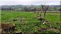
Old trees between fields north of Baggarah
Image: © Luke Shaw
Taken: 24 Apr 2023
0.25 miles