IMAGES TAKEN NEAR TO
Banks, BRAMPTON, CA8 2JH
Introduction
This page details the photographs taken nearby to CA8 2JH by members of the Geograph project.
The Geograph project started in 2005 with the aim of publishing, organising and preserving representative images for every square kilometre of Great Britain, Ireland and the Isle of Man.

There are currently over 7.5m images from over14,400 individuals and you can help contribute to the project by visiting https://www.geograph.org.uk
Image Map
Images are licensed for reuse under creativecommons.org/licenses/by-sa/2.0
Notes
- Clicking on the map will re-center to the selected point.
- The higher the marker number, the further away the image location is from the centre of the postcode.
Image Listing (17 Images Found)
Images are licensed for reuse under creativecommons.org/licenses/by-sa/2.0
Image
Details
Distance
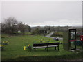
5
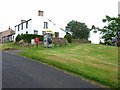
Banks village green
Building behind the telephone box is former Banks Post Office, now private house.
Image: © Oliver Dixon
Taken: 20 Jul 2006
0.09 miles
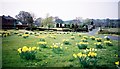
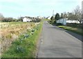
8
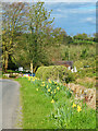
Daffodils on (the course of) Hadrian's Wall
Image: © Mick Garratt
Taken: 25 Apr 2024
0.12 miles
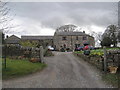
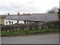
9
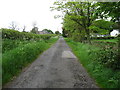
The lane to Banks
The Hadrian's Wall Path comes down (if going east to west) this lane.
Image: © David Purchase
Taken: 30 May 2013
0.12 miles
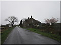
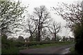
10
The minor road through Banks
The nearest house on the right is called Riggside. It bore the date 1834.
Image: © John Baker
Taken: 29 Mar 2012
0.13 miles