IMAGES TAKEN NEAR TO
West Hall, BRAMPTON, CA8 2ER
Introduction
This page details the photographs taken nearby to CA8 2ER by members of the Geograph project.
The Geograph project started in 2005 with the aim of publishing, organising and preserving representative images for every square kilometre of Great Britain, Ireland and the Isle of Man.

There are currently over 7.5m images from over14,400 individuals and you can help contribute to the project by visiting https://www.geograph.org.uk
Image Map
Images are licensed for reuse under creativecommons.org/licenses/by-sa/2.0
Notes
- Clicking on the map will re-center to the selected point.
- The higher the marker number, the further away the image location is from the centre of the postcode.
Image Listing (13 Images Found)
Images are licensed for reuse under creativecommons.org/licenses/by-sa/2.0
Image
Details
Distance
3
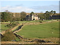
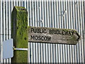
Spadeadam Farm
At the head of a country lane on the edge of the Bewcastle Fells.
Image: © Oliver Dixon
Taken: 20 Dec 2007
0.02 miles
4
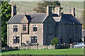
Spadeadam Farm
Unfortunately the tranquillity of the scene doesn't tend to last that long given the nearby RAF base.
Image: © Andrew Smith
Taken: 22 Mar 2007
0.02 miles
5
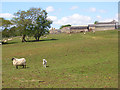
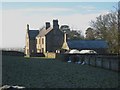
Spadeadam Farm
Looking up to the farm from the bridleway to the east.
Image: © John Hill
Taken: 26 May 2008
0.02 miles
7
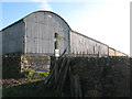
Barns at Spadeadam Farm
Shows the location of Image
Image: © Mike Quinn
Taken: 19 Oct 2011
0.05 miles
8
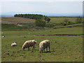
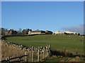
Pasture at Spadeadam
In a field crossed by the bridleway to the west of the farm. In the distance are Blencathra and Skiddaw.
Image: © John Hill
Taken: 26 May 2008
0.14 miles
9
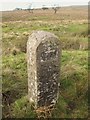
Boundary stone north of Spadeadam
The date on the stone is 1875 - see Image The location of the stone is shown in Image There is another such stone to the south of the farm: Image photographed by Peter McDermott.
Image: © Mike Quinn
Taken: 19 Oct 2011
0.19 miles
10
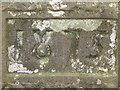
Date on the boundary stone north of Spadeadam
Image: © Mike Quinn
Taken: 19 Oct 2011
0.19 miles