
IMAGES TAKEN NEAR TO
King Street, WIGTON, CA7 9EB
Introduction
This page details the photographs taken nearby to King Street, CA7 9EB by members of the Geograph project.
The Geograph project started in 2005 with the aim of publishing, organising and preserving representative images for every square kilometre of Great Britain, Ireland and the Isle of Man.

There are currently over 7.5m images from over14,400 individuals and you can help contribute to the project by visiting https://www.geograph.org.uk
Image Map
Images are licensed for reuse under creativecommons.org/licenses/by-sa/2.0
Notes
- Clicking on the map will re-center to the selected point.
- The higher the marker number, the further away the image location is from the centre of the postcode.
Image Listing (124 Images Found)
Images are licensed for reuse under creativecommons.org/licenses/by-sa/2.0
Image
Details
Distance
1
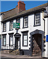
Former HSBC Bank, Wigton - May 2017
Formerly the Cumberland Union Bank and appearing on the 1864 OS Map, it became part of the Midland Bank and later HSBC. An undated notice in the window informs local HSBC customers they must now travel to Carlisle.
Image: © The Carlisle Kid
Taken: 31 May 2017
0.01 miles
2
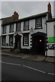
HSBC Bank, Wigton
The archway on the right suggests this may have originally have been a coaching house.
Image: © Philip Halling
Taken: 27 Aug 2008
0.01 miles
3
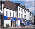
Former "Black Swan" pub and former "Queens Head Hotel" - Wigton - May 2017 (1)
Situated on King Street just below the closed HSBC Bank (see: Image] ) both pre-date the 1864 OS Map. The small two-storey "Black Swan" was once cleverly painted to represent stone blocks. Neither buildings are specifically named on the 1892 OS Map, so may have closed before the end of the 19th Century. Local historian Trevor Grahamslaw ("Wigton Through Time" - Amberley Publishing 2010) records that the hotel eventually became a Co-Operative store, while both buildings became Haldane's grocery store. Current use is clear!
See also: Image] .
Photograph is for record only - I have no connection with any business seen in the view and cannot advise on their products or services.
Image: © The Carlisle Kid
Taken: 31 May 2017
0.02 miles
4
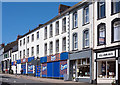
Former "Black Swan" pub and former "Queens Head Hotel" - Wigton - May 2017 (2)
For information on these buildings, see: Image
Image: © The Carlisle Kid
Taken: 31 May 2017
0.02 miles
5
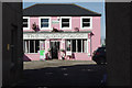
The Glasshouse, Wigton
Pink restaurant on Wheatsheaf Lane.
Image: © Stephen McKay
Taken: 2 Oct 2014
0.02 miles
6
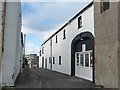
Tiny Tots Nursery, Wigton
In Meetinghouse Lane, on the north side of King Street.
Image: © Christine Johnstone
Taken: 14 Oct 2014
0.02 miles
7
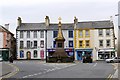
Market Place, Wigton
The fruit and vegetable market was once held here - other markets were situated around the town. The upper storeys of the shops retain their Georgian facades largely unaltered (information from Wigton Town Guide http://www.pluspublishing.co.uk/assets/applets/Wigton_10-12_web.pdf ).
View from High Street to the junction with West Street (left) and King Street (right). Standing on an island is the Moore Memorial Fountain Image .
Image: © Rose and Trev Clough
Taken: 4 Jun 2011
0.03 miles
8
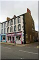
No. 27-28 King Street (Gladrags) at New Street junction
There is an Ordnance Survey benchmark Image on the near corner, right hand face, of the shop
Image: © Luke Shaw
Taken: 23 Jul 2019
0.03 miles
9
Memorial Fountain, Market Square, Wigton
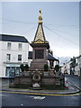
In the market place is an elaborate 19th Century fountain erected in 1872 by George Moore of Whitehall in Mealsgate, in memory of his wife. It is built of granite, and features four fine bronze relief of the Acts of Mercy by the Pre-Raphaelite sculptor Thomas Woolner. On the north side is 'Visiting the Afflicted', the east illustrates 'Clothing the Naked', the south has 'Instructing the Ignorant', and the west side has 'Feeding the Hungry'.
Image: © Alexander P Kapp
Taken: 17 Apr 2008
0.03 miles
10
Market Place, Wigton
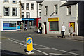
Shoppers stroll through the centre of this pleasant Cumbrian town on a bright autumn morning. Wigton traces its history back to 1100 when the local Lord of the Manor built a church from the remains of a nearby Roman fort. In 1262 Henry II granted a market charter and by the 18th century the town had become associated with the weaving trade. Later dye works were established and calico printing was important in the early 19th century. Other industries including metal working and clock making gradually established themselves but by the end of the 19th century the town found itself unable to compete with the larger industrial centres further south and the area became quite seriously depressed. Today the largest employer is a company producing polypropylene - a thermoplastic polymer used mainly in packaging - which has a workforce of about 900.
Image: © Stephen McKay
Taken: 2 Oct 2014
0.03 miles