
IMAGES TAKEN NEAR TO
The Green, WIGTON, CA7 5EA
Introduction
This page details the photographs taken nearby to The Green, CA7 5EA by members of the Geograph project.
The Geograph project started in 2005 with the aim of publishing, organising and preserving representative images for every square kilometre of Great Britain, Ireland and the Isle of Man.

There are currently over 7.5m images from over14,400 individuals and you can help contribute to the project by visiting https://www.geograph.org.uk
Image Map
Images are licensed for reuse under creativecommons.org/licenses/by-sa/2.0
Notes
- Clicking on the map will re-center to the selected point.
- The higher the marker number, the further away the image location is from the centre of the postcode.
Image Listing (28 Images Found)
Images are licensed for reuse under creativecommons.org/licenses/by-sa/2.0
Image
Details
Distance
1
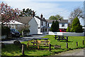
Village Green
This is the centre of the village of Glasson, opposite the pub.
Image: © Anne Burgess
Taken: 7 May 2018
0.01 miles
2
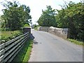
Old railway bridge at Glasson
This bridge crosses what was originally the Port Carlisle to Carlisle canal. It was filled in and replaced with a branch line from Port Carlisle to Drumburgh and serviced using a horse drawn 'Dandy' (think this might be at National Rail Museum York now). The main Carlisle to Silloth railway ran south of Glasson from Drumburgh to Kirkbride.
Image: © Oliver Dixon
Taken: 19 Jul 2006
0.03 miles

5
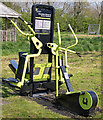
Exercise equipment - Glasson playing fields - May 2017
In good working order and amazingly un-vandalised!
Image: © The Carlisle Kid
Taken: 1 May 2017
0.04 miles
6
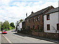
Barrocks House, Glasson
According to the Cicerone Guidebook, Barrocks House is constructed of red sandstone blocks to Roman Wall specification.
The white building beyond Barrocks House is the Highland Laddie Inn (see Image).
Image: © David Purchase
Taken: 2 Jun 2013
0.04 miles
8
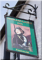
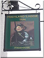
Highland Laddie Inn, Glasson - May 2017 (3)
The pub sign, depicting a haff-netter fisherman!
For information on the pub, see: Image] .
Image: © The Carlisle Kid
Taken: 1 May 2017
0.04 miles
9
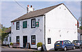
Highland Laddie Inn, Glasson - May 2017 (2)
For information on this building, see: Image] .
Image: © The Carlisle Kid
Taken: 1 May 2017
0.04 miles
10
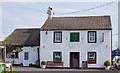
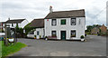
Highland Laddie Inn, Glasson - May 2017 (1)
18th Century inn which was State owned from 1919 until sold for £3,775 in 1973. Still trading.
The Inn is a base for courses on traditional Cumbrian haff-netters fishing and details of these courses may be found: http://www.haafnettersfishing.co.uk/
Photograph is for record only - I have no connection with this business or the haff-netters courses. All queries should be directed through the web site.
State Management Scheme records indicate there were two other pubs in Glasson taken under State control in 1919 - the Grapes Inn and the New Crown Inn, which are presumed instantly closed by the Scheme as there is no record of their later sale. No trace of these establishments can be seen on period OS maps and their location is a mystery.
Image: © The Carlisle Kid
Taken: 1 May 2017
0.04 miles