IMAGES TAKEN NEAR TO
Whitrigg, Kirkbride, WIGTON, CA7 5AA

Introduction

This page details the photographs taken nearby to CA7 5AA by members of the Geograph project.

The Geograph project started in 2005 with the aim of publishing, organising and preserving representative images for every square kilometre of Great Britain, Ireland and the Isle of Man.

There are currently over 7.5m images from over14,400 individuals and you can help contribute to the project by visiting https://www.geograph.org.uk

Image Map


Images are licensed for reuse under creativecommons.org/licenses/by-sa/2.0
Notes
  • Clicking on the map will re-center to the selected point.
  • The higher the marker number, the further away the image location is from the centre of the postcode.

Image Listing (28 Images Found)

Images are licensed for reuse under creativecommons.org/licenses/by-sa/2.0
  • ...
Image
Details
Distance
1
National Cycle Route 72, Whiterigg
Showing position of Postbox CA7 77. See Image] postbox.
Image: © JThomas Taken: 28 May 2016
0.10 miles
2
Close up, Elizabeth II postbox, Whiterigg
Postbox CA7 77. See Image] for wider view. See Image] for context.
Image: © JThomas Taken: 28 May 2016
0.10 miles
3
Elizabeth II postbox, Whiterigg
Postbox CA7 77. See Image] for close up.
Image: © JThomas Taken: 28 May 2016
0.10 miles
4
Whitrigg Station House
The station was on the direct railway route across the Solway on a viaduct. Some distance beyond the house are the masts for Anthorn Radio Transmitting Station.
Image: © Kevin Waterhouse Taken: 22 Aug 2023
0.10 miles
5
Roadside at Whitrigg
Image: © Darrin Antrobus Taken: 14 Aug 2010
0.13 miles
6
House at Whitrigg
Image: © Anthony Parkes Taken: 6 Aug 2014
0.13 miles
7
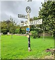
Whitrigg Road Junction
A rather historic-looking (euphemism for old and scruffy) sign points the way at Whitrigg. It was in slightly better condition eight years ago Image
Image: © Anne Burgess Taken: 7 May 2018
0.14 miles
8
Direction Sign – Signpost at Whitrigg
Located on the northwest side of the T junction at Whitrigg in Bowness parish. 3 arms and annulus finial. The destination covered by the blanking plate reads NO THROUGH ROAD which is shown on the reverse of the arm. In 1943 a Royal Naval Air Station was built between Anthorn and Cardurnock, cutting off the road. The airfield shut in 1958 and is now a radio transmission site and at some date the road was relaid around the perimeter of the airfield. See also http://www.geograph.org.uk/photo/5791161 , http://www.geograph.org.uk/photo/2020379 and http://www.geog.port.ac.uk/webmap/thelakes/photos/byw68.jpg. Milestone Society National ID: CU_NY2257
Image: © B Todd Taken: 22 Sep 2023
0.14 miles
9
Houses near West Whitrigg Farm
Image: © Ian S Taken: 9 Sep 2012
0.15 miles
10
The road to Kirkbride
Heading across Whitrigg Bridge, sometimes flooded at high tide.
Image: © David Purchase Taken: 27 Jul 2013
0.20 miles
  • ...