IMAGES TAKEN NEAR TO
Silloth, WIGTON, CA7 4QA
Introduction
This page details the photographs taken nearby to CA7 4QA by members of the Geograph project.
The Geograph project started in 2005 with the aim of publishing, organising and preserving representative images for every square kilometre of Great Britain, Ireland and the Isle of Man.

There are currently over 7.5m images from over14,400 individuals and you can help contribute to the project by visiting https://www.geograph.org.uk
Image Map
Images are licensed for reuse under creativecommons.org/licenses/by-sa/2.0
Notes
- Clicking on the map will re-center to the selected point.
- The higher the marker number, the further away the image location is from the centre of the postcode.
Image Listing (8 Images Found)
Images are licensed for reuse under creativecommons.org/licenses/by-sa/2.0
Image
Details
Distance
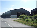
2
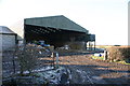
Balladoyle Farm
large general purpose shed
Image: © Bob Jenkins
Taken: 28 Dec 2005
0.03 miles
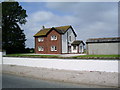
4
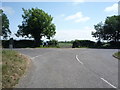
Road junction on the B5301, Balladoyle
Bear right for National Cycle Route 72.
Image: © JThomas
Taken: 18 Jun 2016
0.05 miles
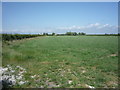
6
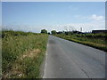
National Cycle Route 72
Heading south east on the B5301.
Image: © JThomas
Taken: 18 Jun 2016
0.21 miles
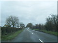
7
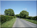
Minor road towards Abbeytown
Heading north east.
Image: © JThomas
Taken: 18 Jun 2016
0.24 miles