IMAGES TAKEN NEAR TO
East Crescent, WIGTON, CA7 3EF
Introduction
This page details the photographs taken nearby to East Crescent, CA7 3EF by members of the Geograph project.
The Geograph project started in 2005 with the aim of publishing, organising and preserving representative images for every square kilometre of Great Britain, Ireland and the Isle of Man.

There are currently over 7.5m images from over14,400 individuals and you can help contribute to the project by visiting https://www.geograph.org.uk
Image Map
Images are licensed for reuse under creativecommons.org/licenses/by-sa/2.0
Notes
- Clicking on the map will re-center to the selected point.
- The higher the marker number, the further away the image location is from the centre of the postcode.
Image Listing (147 Images Found)
Images are licensed for reuse under creativecommons.org/licenses/by-sa/2.0
Image
Details
Distance
1
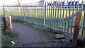
Stone gatepost beside footpath around school playing field
Ordnance Survey records indicate that a pivot benchmark levelled at 66.547m above Newlyn Datum was verified in 1971 on a stone gatepost on the opposite side of the path to the remaining gatepost
Image: © Roger Templeman
Taken: 10 Nov 2023
0.06 miles
3
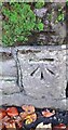
Benchmark on North Road wall of Vicarage Close at junction with churchyard wall
Ordnance Survey cut mark benchmark levelled at 69.489m above Newlyn Datum verified 1971
Image: © Roger Templeman
Taken: 10 Nov 2023
0.15 miles
4
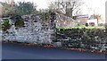
Walls on SW side of North Road outside St Kentigern's churchyard
There is an Ordnance Survey benchmark Image on the left hand side of the junction of the walls with gravestones visible behind the right hand wall
Image: © Roger Templeman
Taken: 10 Nov 2023
0.16 miles
5
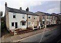
Houses and hair salon on north side of Queen Street
Image: © Roger Templeman
Taken: 28 Oct 2023
0.17 miles
6
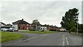
St Mungo's Park housing
On North Road
Image: © Kevin Waterhouse
Taken: 22 Aug 2023
0.17 miles
7
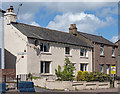
Private house on corner Brough Street and Queen Street, Aspatria - May 2017
This was initially thought to be "Shoulder of Mutton", but further research suggests that was the property to the immediate left and this was never anything more than a private dwelling.
Image: © The Carlisle Kid
Taken: 14 May 2017
0.17 miles
8
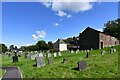
Aspatria, St. Kentigern's Church: The churchyard
Image: © Michael Garlick
Taken: 11 Aug 2024
0.17 miles