IMAGES TAKEN NEAR TO
Park Road, WIGTON, CA7 3DZ
Introduction
This page details the photographs taken nearby to Park Road, CA7 3DZ by members of the Geograph project.
The Geograph project started in 2005 with the aim of publishing, organising and preserving representative images for every square kilometre of Great Britain, Ireland and the Isle of Man.

There are currently over 7.5m images from over14,400 individuals and you can help contribute to the project by visiting https://www.geograph.org.uk
Image Map
Images are licensed for reuse under creativecommons.org/licenses/by-sa/2.0
Notes
- Clicking on the map will re-center to the selected point.
- The higher the marker number, the further away the image location is from the centre of the postcode.
Image Listing (10 Images Found)
Images are licensed for reuse under creativecommons.org/licenses/by-sa/2.0
Image
Details
Distance
2
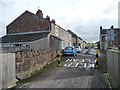
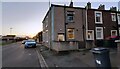
Terraced houses, east side, Springkell, Aspatria
Looking south from the bridge over the railway.
Image: © Christine Johnstone
Taken: 23 Oct 2014
0.10 miles
3
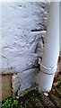
Benchmark behind downpipe on #2 Springkell, Park Road face
Ordnance Survey cut mark benchmark levelled at 62.242m above Newlyn Datum verified 1971
Image: © Roger Templeman
Taken: 10 Nov 2023
0.10 miles
4
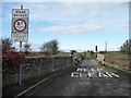
Weak bridge with a timber deck, Springkell, Aspatria
Carrying the access road to Hindrigg and a public footpath over the railway line from Carlisle to Maryport.
Image: © Christine Johnstone
Taken: 23 Oct 2014
0.10 miles
5
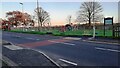
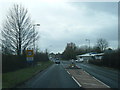
Playground on southeast side of Park Road/Lawson Street
Also in the image Aspatria Town Council noticeboard, letter box on post and bus stop with shelter
Image: © Luke Shaw
Taken: 10 Nov 2023
0.12 miles
6
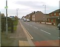
Springkell houses on northwest side of Park Road
There is an Ordnance Survey benchmark Image behind the downpipe on the near corner of the left hand house
Image: © Roger Templeman
Taken: 10 Nov 2023
0.12 miles
8
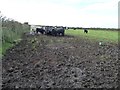
Cattle pasture, south of Hindrigg
On the west side of Springkell.
Image: © Christine Johnstone
Taken: 23 Oct 2014
0.18 miles
9
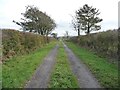
Springkell, Aspatria
Access road from Hindrigg, and public footpath from Pasture House.
Image: © Christine Johnstone
Taken: 23 Oct 2014
0.22 miles
10
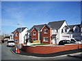
Sheila Fell Close, Aspatria
Named after the locally born artist, Sheila Fell, http://www.tulliehouse.co.uk/pages.asp?type=M&url=264_Local+Artists&lvl=,48,78,264,
Image: © Alexander P Kapp
Taken: 4 Oct 2007
0.22 miles