
IMAGES TAKEN NEAR TO
Hayton, Aspatria, WIGTON, CA7 2PG
Introduction
This page details the photographs taken nearby to CA7 2PG by members of the Geograph project.
The Geograph project started in 2005 with the aim of publishing, organising and preserving representative images for every square kilometre of Great Britain, Ireland and the Isle of Man.

There are currently over 7.5m images from over14,400 individuals and you can help contribute to the project by visiting https://www.geograph.org.uk
Image Map
Images are licensed for reuse under creativecommons.org/licenses/by-sa/2.0
Notes
- Clicking on the map will re-center to the selected point.
- The higher the marker number, the further away the image location is from the centre of the postcode.
Image Listing (10 Images Found)
Images are licensed for reuse under creativecommons.org/licenses/by-sa/2.0
Image
Details
Distance
1

Patten Beck on NW side of main road through Hayton
Image: © Roger Templeman
Taken: 31 Mar 2025
0.01 miles
2

Road towards Hayton passing over Patten Beck
There is an Ordnance Survey benchmark Image on top of the stone at the near end of the bridge parapet
Image: © Roger Templeman
Taken: 31 Mar 2025
0.01 miles
3

Benchmark on stone at east end of south parapet of Patten Beck bridge
Ordnance Survey pivot benchmark levelled at 51.634m above Newlyn Datum verified 1961
Image: © Roger Templeman
Taken: 31 Mar 2025
0.02 miles
4
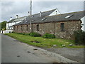
The Barn, Hayton
A barn & farmhouse conversion on the edge of the village of Hayton.
Image: © Matthew Hatton
Taken: 24 May 2014
0.06 miles
6
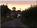
Hayton, near Aspatria
This photo was taken in the lane approaching the village from the east
Image: © Nigel Monckton
Taken: 10 Sep 2005
0.22 miles
7
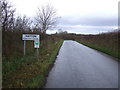
Entering Hayton
The minor road from Aspatria.
Image: © JThomas
Taken: 23 Nov 2019
0.22 miles
8

South View and Butt Hill on north side of main road through Hayton
Image: © Roger Templeman
Taken: 31 Mar 2025
0.23 miles
9

Benchmark on gatepost on south side of road east of Hayton
Ordnance Survey cut mark benchmark levelled at 66.861m above Newlyn Datum verified 1971
Image: © Roger Templeman
Taken: 31 Mar 2025
0.23 miles
10

Field on south side of rural road east of Hayton
There is an Ordnance Survey benchmark Image on the road face of the gatepost at the far side of the gateway
Image: © Roger Templeman
Taken: 31 Mar 2025
0.24 miles