
IMAGES TAKEN NEAR TO
Roadhead, CARLISLE, CA6 6PH
Introduction
This page details the photographs taken nearby to CA6 6PH by members of the Geograph project.
The Geograph project started in 2005 with the aim of publishing, organising and preserving representative images for every square kilometre of Great Britain, Ireland and the Isle of Man.

There are currently over 7.5m images from over14,400 individuals and you can help contribute to the project by visiting https://www.geograph.org.uk
Image Map
Images are licensed for reuse under creativecommons.org/licenses/by-sa/2.0
Notes
- Clicking on the map will re-center to the selected point.
- The higher the marker number, the further away the image location is from the centre of the postcode.
Image Listing (8 Images Found)
Images are licensed for reuse under creativecommons.org/licenses/by-sa/2.0
Image
Details
Distance
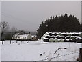
6
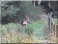
Roe Deer
Came across this deer near "The Flatt"
Image: © David Liddle
Taken: 8 Apr 2008
0.13 miles
7
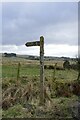
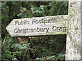
A moss-encrusted fingerpost by Townfoot
The fingerpost is pointing the way to a seldom-used right of way to Christianbury Crags.
Image: © James T M Towill
Taken: 25 Feb 2023
0.14 miles
8
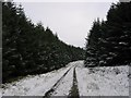
Forest Road, Whitelyne Common
Near the edge of a vast conifer plantation, stretching 30km to the north. A road network was built at the time of planting, for maintenance and to remove the harvested timber. It will not be long before these trees are felled.
Image: © Richard Webb
Taken: 9 Feb 2004
0.20 miles