IMAGES TAKEN NEAR TO
Roweltown, CARLISLE, CA6 6JP
Introduction
This page details the photographs taken nearby to CA6 6JP by members of the Geograph project.
The Geograph project started in 2005 with the aim of publishing, organising and preserving representative images for every square kilometre of Great Britain, Ireland and the Isle of Man.

There are currently over 7.5m images from over14,400 individuals and you can help contribute to the project by visiting https://www.geograph.org.uk
Image Map
Images are licensed for reuse under creativecommons.org/licenses/by-sa/2.0
Notes
- Clicking on the map will re-center to the selected point.
- The higher the marker number, the further away the image location is from the centre of the postcode.
Image Listing (10 Images Found)
Images are licensed for reuse under creativecommons.org/licenses/by-sa/2.0
Image
Details
Distance
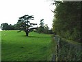
2
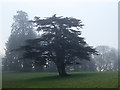
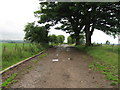
A misty morning at Dormanstead
A Cedar of Lebanon and other specimen trees dot what was clearly a grand country estate at Dormanstead Farm.
Image: © Oliver Dixon
Taken: 30 Nov 2014
0.08 miles
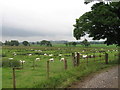
4
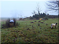
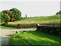
Field with mole hills and sheep
A misty morning at Dormanstead.
Image: © Oliver Dixon
Taken: 30 Nov 2014
0.12 miles
9
Field of sheep south of Dormanstead Farm
Image: © Alex McGregor
Taken: 15 Jul 2010
0.23 miles
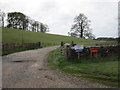
10
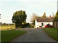
Road junction at Patties Hill
Image: © Rose and Trev Clough
Taken: 30 Sep 2007
0.24 miles