
IMAGES TAKEN NEAR TO
Kirklinton, CARLISLE, CA6 6DA
Introduction
This page details the photographs taken nearby to CA6 6DA by members of the Geograph project.
The Geograph project started in 2005 with the aim of publishing, organising and preserving representative images for every square kilometre of Great Britain, Ireland and the Isle of Man.

There are currently over 7.5m images from over14,400 individuals and you can help contribute to the project by visiting https://www.geograph.org.uk
Image Map
Images are licensed for reuse under creativecommons.org/licenses/by-sa/2.0
Notes
- Clicking on the map will re-center to the selected point.
- The higher the marker number, the further away the image location is from the centre of the postcode.
Image Listing (10 Images Found)
Images are licensed for reuse under creativecommons.org/licenses/by-sa/2.0
Image
Details
Distance


4
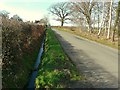
Hedge and ditch
Country road approaching a junction at Fergushill.
Image: © Rose and Trev Clough
Taken: 10 Apr 2010
0.07 miles
5

Northern boundary of Hethermoor Plantation
Mixed woodland.
Image: © Rose and Trev Clough
Taken: 10 Apr 2010
0.07 miles
6

Hether Burn
View upstream from Burnside Bridge.
Image: © Rose and Trev Clough
Taken: 10 Apr 2010
0.17 miles
7

Inscribed stone on Burnside Bridge
Presumably the bridge was widened in 1937, and the date altered by a graffitist of above average skill.
Image: © Rose and Trev Clough
Taken: 10 Apr 2010
0.18 miles
8

Burnside Bridge
Crossing the Hether Burn.
An inscribed stone records the date the bridge was widened http://www.geograph.org.uk/photo/1816190 .
Image: © Rose and Trev Clough
Taken: 10 Apr 2010
0.19 miles
9

Sheep at their feeder
Near Burnside Bridge. Kirklinton Church can just be seen on the horizon (right).
The sign points out a public footpath to Cliff Bridge.
Image: © Rose and Trev Clough
Taken: 10 Apr 2010
0.20 miles
