IMAGES TAKEN NEAR TO
Kirklinton, CARLISLE, CA6 6AZ
Introduction
This page details the photographs taken nearby to CA6 6AZ by members of the Geograph project.
The Geograph project started in 2005 with the aim of publishing, organising and preserving representative images for every square kilometre of Great Britain, Ireland and the Isle of Man.

There are currently over 7.5m images from over14,400 individuals and you can help contribute to the project by visiting https://www.geograph.org.uk
Image Map
Images are licensed for reuse under creativecommons.org/licenses/by-sa/2.0
Notes
- Clicking on the map will re-center to the selected point.
- The higher the marker number, the further away the image location is from the centre of the postcode.
Image Listing (10 Images Found)
Images are licensed for reuse under creativecommons.org/licenses/by-sa/2.0
Image
Details
Distance
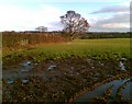
2

Bridge at Hetherside
Over minor stream south of Kirklinton.
Image: © Oliver Dixon
Taken: 3 Nov 2010
0.07 miles
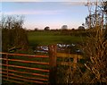
5
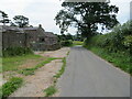
Minor road at Hetherside
Looking south-eastward.
Image: © Peter Wood
Taken: 8 Jul 2023
0.13 miles
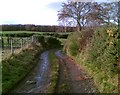
7
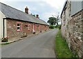
Minor road at Dykeside
Looking south-eastward.
Image: © Peter Wood
Taken: 8 Jul 2023
0.14 miles
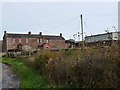
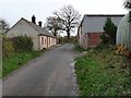
10
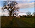
Dykeside
The road from Smithfield to Kirklinton with Dykeside Farm in the background
Image: © Adrian Taylor
Taken: 24 Nov 2006
0.23 miles