IMAGES TAKEN NEAR TO
Lochinvar Close, CARLISLE, CA6 5XU
Introduction
This page details the photographs taken nearby to Lochinvar Close, CA6 5XU by members of the Geograph project.
The Geograph project started in 2005 with the aim of publishing, organising and preserving representative images for every square kilometre of Great Britain, Ireland and the Isle of Man.

There are currently over 7.5m images from over14,400 individuals and you can help contribute to the project by visiting https://www.geograph.org.uk
Image Map
Images are licensed for reuse under creativecommons.org/licenses/by-sa/2.0
Notes
- Clicking on the map will re-center to the selected point.
- The higher the marker number, the further away the image location is from the centre of the postcode.
Image Listing (37 Images Found)
Images are licensed for reuse under creativecommons.org/licenses/by-sa/2.0
Image
Details
Distance
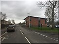
2
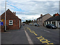
Moor Crescent, Longtown
A residential road in a loop. There is a school to the left.
Image: © Richard Webb
Taken: 13 Feb 2019
0.07 miles
3
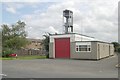
Longtown fire station
Longtown fire station, Mary Street, Longtown, Cumbria
Image: © Kevin Hale
Taken: 2 Aug 2010
0.08 miles
4
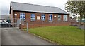
Pear Tree Nursery
There is an Ordnance Survey benchmark Image on the left hand side of the school at its front corner
Image: © Roger Templeman
Taken: 4 May 2021
0.11 miles
5
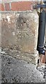
Benchmark on Pear Tree Nursery
Ordnance Survey cut mark benchmark levelled at 20.504m above Newlyn Datum verified in 1955
Image: © Roger Templeman
Taken: 4 May 2021
0.11 miles
6

Benchmark on gatepost on SE side of Moor Road
Ordnance Survey cut mark benchmark levelled at 24.015m above Newlyn Datum verified 1955
Image: © Roger Templeman
Taken: 4 May 2021
0.13 miles
8
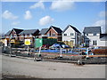
Colourful houses on Moor Road, Longtown
Image: © Oliver Dixon
Taken: 10 May 2019
0.16 miles
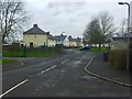
9
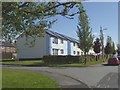
New houses, Sutton Court, Longtown
Image: © Alexander P Kapp
Taken: 23 Apr 2008
0.16 miles
10
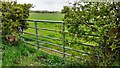
View through field gate on SE side of Moor Road towards wind turbines
There is an Ordnance Survey benchmark Image on the inside face of the gatepost at the left hand side of the gate
Image: © Roger Templeman
Taken: 4 May 2021
0.17 miles