IMAGES TAKEN NEAR TO
Longtown, CARLISLE, CA6 5RG
Introduction
This page details the photographs taken nearby to CA6 5RG by members of the Geograph project.
The Geograph project started in 2005 with the aim of publishing, organising and preserving representative images for every square kilometre of Great Britain, Ireland and the Isle of Man.

There are currently over 7.5m images from over14,400 individuals and you can help contribute to the project by visiting https://www.geograph.org.uk
Image Map
Images are licensed for reuse under creativecommons.org/licenses/by-sa/2.0
Notes
- Clicking on the map will re-center to the selected point.
- The higher the marker number, the further away the image location is from the centre of the postcode.
Image Listing (5 Images Found)
Images are licensed for reuse under creativecommons.org/licenses/by-sa/2.0
Image
Details
Distance
1
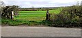
Field gateway on south side of rural road west of Highmoorhead
Image: © Roger Templeman
Taken: 14 Apr 2022
0.06 miles
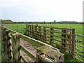
5
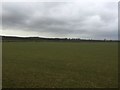
Field, Low Plains
Grassland during Winter. A following mild spell probably got it growing.
Image: © Richard Webb
Taken: 13 Feb 2019
0.25 miles