
IMAGES TAKEN NEAR TO
Kirkandrews Moat, CARLISLE, CA6 5PH
Introduction
This page details the photographs taken nearby to Kirkandrews Moat, CA6 5PH by members of the Geograph project.
The Geograph project started in 2005 with the aim of publishing, organising and preserving representative images for every square kilometre of Great Britain, Ireland and the Isle of Man.

There are currently over 7.5m images from over14,400 individuals and you can help contribute to the project by visiting https://www.geograph.org.uk
Image Map
Images are licensed for reuse under creativecommons.org/licenses/by-sa/2.0
Notes
- Clicking on the map will re-center to the selected point.
- The higher the marker number, the further away the image location is from the centre of the postcode.
Image Listing (5 Images Found)
Images are licensed for reuse under creativecommons.org/licenses/by-sa/2.0
Image
Details
Distance
1
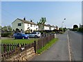
Kirkandrews Moat
Small fairly modern settlement to the north of Longtown.
Image: © Oliver Dixon
Taken: 29 Apr 2011
0.03 miles
2
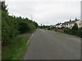
Road at Kirkandrews Moat
Looking south-westward.
Image: © Peter Wood
Taken: 25 Sep 2021
0.04 miles
3
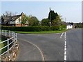
Road junction at the Mount
At the north end of Kirkandrews Moat.
Image: © Oliver Dixon
Taken: 29 Apr 2011
0.08 miles
4
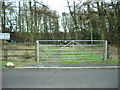
Gate to Sewage works at Moat Common
Image: © Alexander P Kapp
Taken: 23 Jan 2007
0.12 miles
5
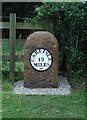
Old Milestone by Moat Vale
Metal plate attached to stone post by the UC road, in parish of KIRKANDREWS (CARLISLE District), Moat Common, Carwinley, on grass verge, on East side of road. Carlisle round iron plate, erected by the Longtown, Snab & Haithwaite Bridge turnpike trust in the 19th century.
Inscription reads:-
CARLISLE
12
MILES
-
Grade II Listed. List Entry Number: 1205452
https://historicengland.org.uk/listing/the-list/list-entry/1205452
Milestone Society National ID: CU_CLHW12.
Image: © CF Smith
Taken: 21 Feb 2011
0.22 miles