IMAGES TAKEN NEAR TO
Gaitle Bridge, CARLISLE, CA6 5LU
Introduction
This page details the photographs taken nearby to Gaitle Bridge, CA6 5LU by members of the Geograph project.
The Geograph project started in 2005 with the aim of publishing, organising and preserving representative images for every square kilometre of Great Britain, Ireland and the Isle of Man.

There are currently over 7.5m images from over14,400 individuals and you can help contribute to the project by visiting https://www.geograph.org.uk
Image Map
Images are licensed for reuse under creativecommons.org/licenses/by-sa/2.0
Notes
- Clicking on the map will re-center to the selected point.
- The higher the marker number, the further away the image location is from the centre of the postcode.
Image Listing (14 Images Found)
Images are licensed for reuse under creativecommons.org/licenses/by-sa/2.0
Image
Details
Distance
1
Entrance to MOD Longtown
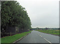
From A6071 west
Image: © John Firth
Taken: 24 Jul 2012
0.06 miles

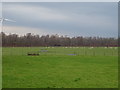
3
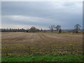
Stubble field, Gaitle Bridge
Off the A6071.
Image: © JThomas
Taken: 20 Nov 2019
0.12 miles
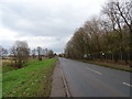
4
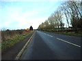
A6071
A6071 near to the entrance to MOD Longton
Image: © Alexander P Kapp
Taken: 23 Jan 2007
0.13 miles
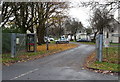
8

The entrance to the housing estate at DSDA Longtown
Image: © Ian S
Taken: 6 May 2012
0.16 miles
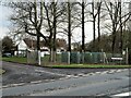
9
Entrance to Defence Munitions Depot housing
Off the A6071.
Image: © JThomas
Taken: 20 Nov 2019
0.16 miles
10
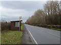
Green Mill Road
Entrance to Green Mill Road off the A6071 Longtown.
Image: © Steve Houldsworth
Taken: 29 Jan 2022
0.16 miles