
IMAGES TAKEN NEAR TO
Duchess Avenue, CARLISLE, CA6 4SN
Introduction
This page details the photographs taken nearby to Duchess Avenue, CA6 4SN by members of the Geograph project.
The Geograph project started in 2005 with the aim of publishing, organising and preserving representative images for every square kilometre of Great Britain, Ireland and the Isle of Man.

There are currently over 7.5m images from over14,400 individuals and you can help contribute to the project by visiting https://www.geograph.org.uk
Image Map
Images are licensed for reuse under creativecommons.org/licenses/by-sa/2.0
Notes
- Clicking on the map will re-center to the selected point.
- The higher the marker number, the further away the image location is from the centre of the postcode.
Image Listing (16 Images Found)
Images are licensed for reuse under creativecommons.org/licenses/by-sa/2.0
Image
Details
Distance
1
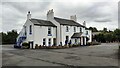
Park House Hotel
There is an Ordnance Survey flush bracket benchmark Image on the near corner, left hand face of the building
Image: © Roger Templeman
Taken: 17 Aug 2021
0.11 miles
2
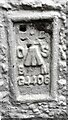
Benchmark on Park House Hotel
Ordnance Survey flush bracket (serial identifier G4406) benchmark described on the Bench Mark Database at www.bench-marks.org.uk/bm18635
Image: © Roger Templeman
Taken: 17 Aug 2021
0.11 miles
3
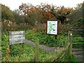
Entrance to Kingmoor (North) Nature Reserve
Kingmoor is the oldest nature reserve in Cumbria, established in 1914. It was once a continuous strip of woodland over 2km long. The central section was felled in 1933 to build an airfield, which later became the Kingstown Industrial Estate. The remaining north and south reserves are today connected by a footpath which follows the route of the dismantled Waverley Railway Line. The reserve is managed by Carlisle City Council. (Information in this description taken from the board shown in the photo).
Image: © Rose and Trev Clough
Taken: 12 Nov 2008
0.11 miles
4
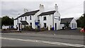
Park House Hotel on SW side of Parkhouse Road
Image: © Luke Shaw
Taken: 17 Aug 2021
0.11 miles
5
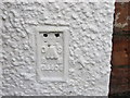
Ordnance Survey Flush Bracket G4406
This can be found on the wall of a building at the Gallo Rosso Restaurant at Parkhouse.
For more detail see : http://www.bench-marks.org.uk/bm16635
Image: © Peter Wood
Taken: 27 Sep 2014
0.11 miles
6
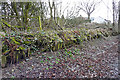
Parkhouse Halt - remains of platform
This was a station on the Waverley railway line https://en.wikipedia.org/wiki/Waverley_Route . It was built in 1941 for workers at RAF Kingstown (renamed RAF Carlisle after the war, latterly 14 Maintenance Unit). The railway and halt (with a footbridge over the track) can be seen in this aerial photo of the 14MU complex taken in 1946 https://britainfromabove.org.uk/image/eaw000294 .
Parkhouse Halt was not intended for use by the general public. It closed along with the rest of the Waverley route in 1969. For more detailed information, see the Disused Stations website http://www.disused-stations.org.uk/p/park_house_halt/index.shtml .
Today a shared-use path occupies the former railway trackbed, running north to south through Kingmoor Nature Reserve.
Image: © Rose and Trev Clough
Taken: 14 Feb 2018
0.14 miles
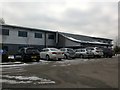
9
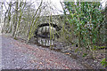
Bridge over dismantled Waverley railway line
Parkhouse Road crosses the former railway line from Carlisle to Edinburgh, which was closed in 1969 (for information about the Waverley route see Wikipedia https://en.wikipedia.org/wiki/Waverley_Route ). A few metres through the bridge, the M6 cuts onward access to the line.
The location is in Kingmoor North nature reserve https://www.geograph.org.uk/photo/1054626 where the shared-use path continues south along the old railway trackbed.
Image: © Rose and Trev Clough
Taken: 14 Feb 2018
0.18 miles
10
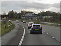
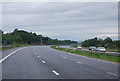
Southbound M6
The southbound M6, north of junction 44 (Carlisle).
Image: © David Dixon
Taken: 27 Oct 2011
0.19 miles