
IMAGES TAKEN NEAR TO
The Orchard, CARLISLE, CA6 4RT
Introduction
This page details the photographs taken nearby to The Orchard, CA6 4RT by members of the Geograph project.
The Geograph project started in 2005 with the aim of publishing, organising and preserving representative images for every square kilometre of Great Britain, Ireland and the Isle of Man.

There are currently over 7.5m images from over14,400 individuals and you can help contribute to the project by visiting https://www.geograph.org.uk
Image Map
Images are licensed for reuse under creativecommons.org/licenses/by-sa/2.0
Notes
- Clicking on the map will re-center to the selected point.
- The higher the marker number, the further away the image location is from the centre of the postcode.
Image Listing (31 Images Found)
Images are licensed for reuse under creativecommons.org/licenses/by-sa/2.0
Image
Details
Distance
1
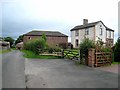
Linstock Farm
At the eastern end of the village on Hadrian's Wall National Trail http://www.nationaltrail.co.uk/hadrianswall/
Image: © Oliver Dixon
Taken: 28 Aug 2008
0.02 miles
2
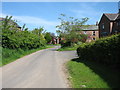
Modern housing in Linstock
Seen from the Hadrian's Wall Path.
Image: © David Purchase
Taken: 31 May 2013
0.04 miles
3
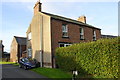
Bramblewood, Stile Farm
There is an OS benchmark Image near the facing corner, road face, of the house
Image: © Roger Templeman
Taken: 16 Sep 2019
0.04 miles
4
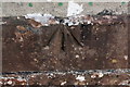
Benchmark on Bramblewood, Stile Farm
Ordnance Survey pivot benchmark levelled at 22.238m above Newlyn Datum
Image: © Roger Templeman
Taken: 16 Sep 2019
0.04 miles
5
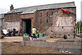
Barn conversion in progress
A photo taken in 2012 Image shows the site before redevelopment, with a byre and cart shed attached to the main barn.
Image: © Rose and Trev Clough
Taken: 19 Aug 2015
0.05 miles
9
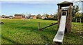
Playground, recreation ground and village green
Image: © Luke Shaw
Taken: 14 Nov 2022
0.08 miles
10
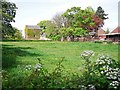
Linstock Castle Farm
The tall building on the left is the castle - otherwise described as a tower house https://en.wikipedia.org/wiki/Tower_houses_in_Britain_and_Ireland . Built in the 12th or early 13th century as a palace for the Bishops of Carlisle, it was later used as a prison and as a refuge for villagers during border raids. In more peaceful times, it became a farmhouse.
Linstock Castle is a Grade II* listed building - for details see http://www.imagesofengland.org.uk/Details/Default.aspx?id=77660 .
Image: © Rose and Trev Clough
Taken: 10 May 2017
0.09 miles