
IMAGES TAKEN NEAR TO
Church Close, CARLISLE, CA6 4PB
Introduction
This page details the photographs taken nearby to Church Close, CA6 4PB by members of the Geograph project.
The Geograph project started in 2005 with the aim of publishing, organising and preserving representative images for every square kilometre of Great Britain, Ireland and the Isle of Man.

There are currently over 7.5m images from over14,400 individuals and you can help contribute to the project by visiting https://www.geograph.org.uk
Image Map
Images are licensed for reuse under creativecommons.org/licenses/by-sa/2.0
Notes
- Clicking on the map will re-center to the selected point.
- The higher the marker number, the further away the image location is from the centre of the postcode.
Image Listing (32 Images Found)
Images are licensed for reuse under creativecommons.org/licenses/by-sa/2.0
Image
Details
Distance
1
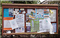
Parish Church of St Kentigern, Irthington - July 2016 (4)
Irthington Parish Council notice board.
Photograph is for record only - I have no connection with any organisation seen in this view and cannot advise on their products or services.
Image: © The Carlisle Kid
Taken: 17 Jul 2016
0.03 miles
2
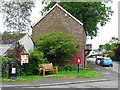
Village amenities, Irthington
Litter bin, notice board, bench and postbox on a small patch of grass.
Image: © Rose and Trev Clough
Taken: 3 Jun 2018
0.03 miles
3
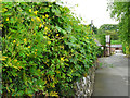
Greater celandine - Chelidonium majus
Greater celandine https://en.wikipedia.org/wiki/Chelidonium_majus is a member of the poppy family and is unrelated to the lesser celandine, which belongs to the buttercup family - see Image . When torn, the plant exudes a distinctive orange/yellow sap.
Growing from the top of a wall round St Kentigern's churchyard.
Image: © Rose and Trev Clough
Taken: 3 Jun 2018
0.03 miles
4
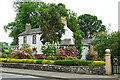
A colourful garden at Irthington
Shrubs in the grounds of The Grange, which is out of sight. The white house is next door - see Image .
Image: © Rose and Trev Clough
Taken: 3 Jun 2018
0.03 miles
5
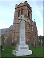
St. Kentigern's church tower and war memorial, Irthington
Church full of local red sandstone in a quiet village about six miles east of Carlisle.
Image: © Jonathan Billinger
Taken: 16 Jul 2007
0.04 miles
6
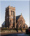
Parish Church of St Kentigern, Irthington - November 2016
For an earlier view and information on this building, see: Image] .
Image: © The Carlisle Kid
Taken: 24 Nov 2016
0.04 miles
7
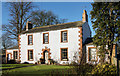
The Croft, Irthington - November 2016
Early 19th Century Grade II listed farmhouse in the village of Irthington.
Private dwelling with no public access.
Image: © The Carlisle Kid
Taken: 24 Nov 2016
0.04 miles
8
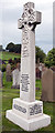
Parish Church of St Kentigern, Irthington - July 2016 (3)
Irthington War Memorial, which is situated in the grounds of St Kentigern's Church - see also: Image] .
Image: © The Carlisle Kid
Taken: 17 Jul 2016
0.04 miles
9
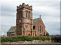
Parish Church of St Kentigern, Irthington - July 2016 (1)
Said to date from Norman times (with bits of Hadrian's Wall incorporated into the building), the Church was restored in 1849 with later work including the construction of a five bell clock tower. Additional information can be found on Wikipedia at: https://en.wikipedia.org/wiki/Irthington
Sadly, the Church is locked outside hours of worship.
Image: © The Carlisle Kid
Taken: 17 Jul 2016
0.04 miles
10
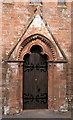
Parish Church of St Kentigern, Irthington - July 2016 (2)
Main entrance door. See also:Image] .
Image: © The Carlisle Kid
Taken: 17 Jul 2016
0.04 miles