IMAGES TAKEN NEAR TO
Harker, CARLISLE, CA6 4HW
Introduction
This page details the photographs taken nearby to CA6 4HW by members of the Geograph project.
The Geograph project started in 2005 with the aim of publishing, organising and preserving representative images for every square kilometre of Great Britain, Ireland and the Isle of Man.

There are currently over 7.5m images from over14,400 individuals and you can help contribute to the project by visiting https://www.geograph.org.uk
Image Map
Images are licensed for reuse under creativecommons.org/licenses/by-sa/2.0
Notes
- Clicking on the map will re-center to the selected point.
- The higher the marker number, the further away the image location is from the centre of the postcode.
Image Listing (8 Images Found)
Images are licensed for reuse under creativecommons.org/licenses/by-sa/2.0
Image
Details
Distance
2
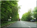
A7 heading south passing Albert Cottage behind wooden fencing
Ordnance Survey records indicate that a flush bracket (serial number 1446) was levelled in 1953 at 27.498m above Newlyn Datum on the north face of Albert Cottage. The house appears to have been rebuilt since then
Image: © Luke Shaw
Taken: 16 Apr 2021
0.03 miles
3
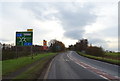
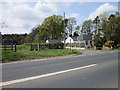
A7 approaching Greymoorhill Roundabout
Junction 44 of the M6 Motorway.
Image: © JThomas
Taken: 20 Nov 2019
0.07 miles
4
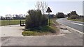
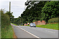
A7 approaching M6 roundabout at entrance to Albert Cottage
Ordnance Survey records indicate that a benchmark levelled at 26.095m above Newlyn Datum was verified in 1953 on a gatepost at a hedge/fence junction at this location
Image: © Roger Templeman
Taken: 16 Apr 2021
0.07 miles
5

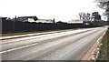
Lights at Junction 44, M6
Waiting to enter the roundabout from the A689.
Image: © wfmillar
Taken: 23 Mar 2014
0.19 miles