
IMAGES TAKEN NEAR TO
Waters Meet, CARLISLE, CA4 8RT
Introduction
This page details the photographs taken nearby to Waters Meet, CA4 8RT by members of the Geograph project.
The Geograph project started in 2005 with the aim of publishing, organising and preserving representative images for every square kilometre of Great Britain, Ireland and the Isle of Man.

There are currently over 7.5m images from over14,400 individuals and you can help contribute to the project by visiting https://www.geograph.org.uk
Image Map
Images are licensed for reuse under creativecommons.org/licenses/by-sa/2.0
Notes
- Clicking on the map will re-center to the selected point.
- The higher the marker number, the further away the image location is from the centre of the postcode.
Image Listing (69 Images Found)
Images are licensed for reuse under creativecommons.org/licenses/by-sa/2.0
Image
Details
Distance
1
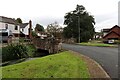
Mill Leat, Warwick Bridge
This supplies the recently restored corn mill that was at work producing flour. The houses are built on land that formerly belonged to the mill.
Image: © Chris Allen
Taken: 28 Sep 2023
0.02 miles
3
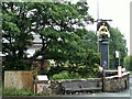
George pub sign, Warwick Bridge 2007
Unfortunately we didn't get a photo of The George Inn itself, which was just to the left of here, before it was demolished in 2008.
Over the wall behind the bench, there is an information board describing Image .
Image: © Rose and Trev Clough
Taken: 30 Jun 2007
0.06 miles
4
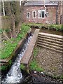
Cairn Beck fish pass
This was built in 2003, to enable migratory fish such as salmon, lamprey, sea trout and brown trout to access spawning and nursery habitats in the upper reaches of the stream. Water flow is slowed down by metal plates set in the slope. This weir, and another upstream, had stopped the movement of fish for more than 100 years. Cairn Beck is a tributary of the River Eden.
(Description mainly drawn from an adjacent information board).
Image: © Rose and Trev Clough
Taken: 6 May 2012
0.06 miles
5
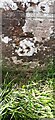
Benchmark on NW parapet of bridge over Cairn Beck
Ordnance Survey cut mark benchmark levelled at 26.430m above Newlyn Datum verified 1972
Image: © Roger Templeman
Taken: 16 Jul 2022
0.06 miles
6
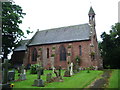
Our Lady and St Wilfred Church, Warwick Bridge
Image: © Alexander P Kapp
Taken: 18 Jul 2008
0.07 miles
7
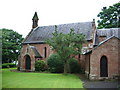
Our Lady and St Wilfred Church, Warwick Bridge
Image: © Alexander P Kapp
Taken: 18 Jul 2008
0.07 miles
8
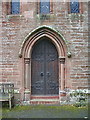
Our Lady and St Wilfred Church, Warwick Bridge, Doorway
Image: © Alexander P Kapp
Taken: 18 Jul 2008
0.07 miles
9
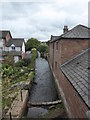
Warwick Bridge Mill - head-race
Seen from the scaffolding surrounding the mill during restoration. A cofferdam keeps the water at bay for work in the wheel pit.
Image: © Chris Allen
Taken: 16 Sep 2018
0.07 miles
10
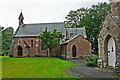
The Church of Our Lady and St Wilfrid
A Roman Catholic church designed by A W N Pugin http://en.wikipedia.org/wiki/Augustus_Pugin , it is in Victorian Gothic style and has a richly decorated interior (see photo http://www.geograph.org.uk/photo/4303912 ). Built in 1841 under the patronage of the Howard family of Corby Castle.
The church, originally called St Mary's, is a Grade II* listed building (see English Heritage for details http://www.imagesofengland.org.uk/details/default.aspx?id=77754 ).
The porch of the Presbytery, also by Pugin, is on the right.
Image: © Rose and Trev Clough
Taken: 19 Jul 2014
0.07 miles