IMAGES TAKEN NEAR TO
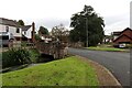
Eden Grange, CARLISLE, CA4 8QW
Introduction
This page details the photographs taken nearby to Eden Grange, CA4 8QW by members of the Geograph project.
The Geograph project started in 2005 with the aim of publishing, organising and preserving representative images for every square kilometre of Great Britain, Ireland and the Isle of Man.

There are currently over 7.5m images from over14,400 individuals and you can help contribute to the project by visiting https://www.geograph.org.uk
Image Map
Images are licensed for reuse under creativecommons.org/licenses/by-sa/2.0
Notes
- Clicking on the map will re-center to the selected point.
- The higher the marker number, the further away the image location is from the centre of the postcode.
Image Listing (69 Images Found)
Images are licensed for reuse under creativecommons.org/licenses/by-sa/2.0
Image
Details
Distance
1
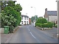
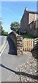
Little Corby
The white house on the left is the Haywain public house
Image: © Oliver Dixon
Taken: 20 Jul 2006
0.10 miles
2
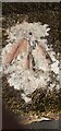
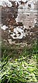
Benchmark on top of boundary wall of #1 Hill Crest
Ordnance Survey pivot benchmark levelled at 29.453m above Newlyn Datum verified 1972
Image: © Roger Templeman
Taken: 16 Jul 2022
0.11 miles
3
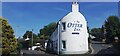
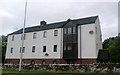
'the Otter Inn' at road junction on SE side of Little Corby Road
Image: © Luke Shaw
Taken: 16 Jul 2022
0.11 miles
4
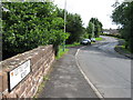
Village road passing Hill Crest
There is an Ordnance Survey benchmark Image on top of the wall between the pavement and path to house at its near end
Image: © Roger Templeman
Taken: 16 Jul 2022
0.11 miles
5
Benchmark on NW parapet of bridge over Cairn Beck
Ordnance Survey cut mark benchmark levelled at 26.430m above Newlyn Datum verified 1972
Image: © Roger Templeman
Taken: 16 Jul 2022
0.11 miles
7
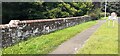
Parapet of bridge over Cairn Beck on NW side of A69 near Corby Hill sign
There is an Ordnance Survey benchmark Image on the near end, road face, of the parapet
Image: © Roger Templeman
Taken: 16 Jul 2022
0.11 miles
8
Mill Leat, Warwick Bridge
This supplies the recently restored corn mill that was at work producing flour. The houses are built on land that formerly belonged to the mill.
Image: © Chris Allen
Taken: 28 Sep 2023
0.11 miles
9
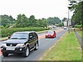
A69, Warwick Bridge
The village of Warwick Bridge is bisected by the very busy A69 Carlisle to Newcastle road
Image: © Oliver Dixon
Taken: 20 Jul 2006
0.13 miles