
IMAGES TAKEN NEAR TO
Wreay, CARLISLE, CA4 0SA
Introduction
This page details the photographs taken nearby to CA4 0SA by members of the Geograph project.
The Geograph project started in 2005 with the aim of publishing, organising and preserving representative images for every square kilometre of Great Britain, Ireland and the Isle of Man.

There are currently over 7.5m images from over14,400 individuals and you can help contribute to the project by visiting https://www.geograph.org.uk
Image Map
Images are licensed for reuse under creativecommons.org/licenses/by-sa/2.0
Notes
- Clicking on the map will re-center to the selected point.
- The higher the marker number, the further away the image location is from the centre of the postcode.
Image Listing (14 Images Found)
Images are licensed for reuse under creativecommons.org/licenses/by-sa/2.0
Image
Details
Distance
1
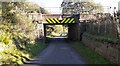
Bridge CGJ7/224 taking West Coast Main Line over Wreay Road
There is an Ordnance Survey benchmark Image at the base of the left hand wall of the bridge
Image: © Roger Templeman
Taken: 4 Nov 2021
0.07 miles
2
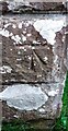
Benchmark on Wreay Road railway bridge
Ordnance Survey cut mark benchmark levelled at 69.522m above Newlyn Datum verified 1970
Image: © Roger Templeman
Taken: 4 Nov 2021
0.09 miles
3
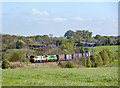
90044 & 90045 at Wreay - May 2017
Still sporting faded Railfreight Distribution International colours, 90044 leads Freightliner liveried 90045 north through Wreay with train 4S44, the 12.13 Daventry – Coatbridge “Freightliner” service.
Image: © The Carlisle Kid
Taken: 9 May 2017
0.11 miles
4
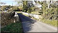
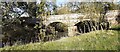
Wreay Bridge over River Petteril
There is an Ordnance Survey benchmark Image on top of the left hand parapet at its middle
Image: © Roger Templeman
Taken: 4 Nov 2021
0.11 miles
5
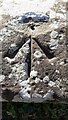
Benchmark on SW parapet of Wreay Bridge
Ordnance Survey rivet benchmark levelled at 56.114m above Newlyn Datum in 1970
Image: © Roger Templeman
Taken: 4 Nov 2021
0.12 miles
6
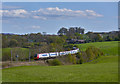
Pendolino at Wreay - April 2017
A Virgin Trains "Pendolino" approaches the site of Wreay station with the 12.28 passenger service from London Euston to Glasgow.
Image: © The Carlisle Kid
Taken: 23 Apr 2017
0.12 miles
7
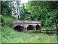
Wreay bridge
There are 2 bridges which cross the River Petteril within a few hundred yards. This one carries the road which runs downhill from Wreay village past the Plough Inn and under the Carlisle to London railway line before crossing the river. The nearby Crooks Bridge also features in this same grid-square.
Image: © Brian Norman
Taken: 21 Jun 2008
0.12 miles
10
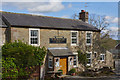
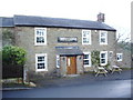
Plough Inn, Wreay - April 2017 (1)
Now "The Plough Inn" and dating from 1786, this is the meeting place for the "Twelve Men of Wreay" (see: http://test.cnmedia.co.uk/twelve-men-over-four-centuries-keeping-cumbrian-village-tradition-alive-1.764378 )
Date of acquisition by the State Management Scheme has not been traced, but Scheme records show the Plough Inn sold to Scottish & Newcastle on 8 April 1973. Still trading.
See also: Image] .
Photograph is for record only - I have no connection with this business and am unable to advise on its products or services.
Image: © The Carlisle Kid
Taken: 17 Apr 2017
0.24 miles