
IMAGES TAKEN NEAR TO
Tarraby, CARLISLE, CA3 0JS
Introduction
This page details the photographs taken nearby to CA3 0JS by members of the Geograph project.
The Geograph project started in 2005 with the aim of publishing, organising and preserving representative images for every square kilometre of Great Britain, Ireland and the Isle of Man.

There are currently over 7.5m images from over14,400 individuals and you can help contribute to the project by visiting https://www.geograph.org.uk
Image Map
Images are licensed for reuse under creativecommons.org/licenses/by-sa/2.0
Notes
- Clicking on the map will re-center to the selected point.
- The higher the marker number, the further away the image location is from the centre of the postcode.
Image Listing (40 Images Found)
Images are licensed for reuse under creativecommons.org/licenses/by-sa/2.0
Image
Details
Distance
1
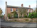
Houses in Tarraby
On the north side of Tarraby Lane.
Image: © Christine Johnstone
Taken: 2 Nov 2015
0.01 miles
2
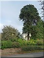
Monkey puzzle tree in a Tarraby garden
On the north side of Tarraby Lane.
Image: © Christine Johnstone
Taken: 2 Nov 2015
0.01 miles
3
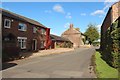
Houses in Tarraby
The houses in Tarraby are mostly arranged on the sides of this minor lane.
Image: © Graham Robson
Taken: 6 Oct 2018
0.02 miles
4
![Tarraby Lane, Tarraby [1]](https://s3.geograph.org.uk/geophotos/04/73/11/4731163_0e8315b7_120x120.jpg)
Tarraby Lane, Tarraby [1]
Looking north-east.
Image: © Christine Johnstone
Taken: 2 Nov 2015
0.02 miles
5
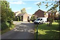
The lane through Tarraby
The lane passing through the small hamlet of Tarraby.
Image: © Graham Robson
Taken: 6 Oct 2018
0.03 miles
6
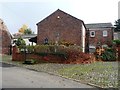
Water pump, Tarraby
Outside the Tarraby Clydesdale Stud, on the east side of Tarraby Lane.
Image: © Christine Johnstone
Taken: 2 Nov 2015
0.03 miles
7
![Tarraby Lane, Tarraby [2]](https://s0.geograph.org.uk/geophotos/04/73/11/4731164_ab91f22a_120x120.jpg)
Tarraby Lane, Tarraby [2]
Looking south-west.
Image: © Christine Johnstone
Taken: 2 Nov 2015
0.03 miles
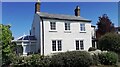
9
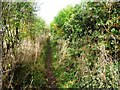
Public footpath, Tarraby
The path has been diverted from the south-east side of the village to the south-west.
Image: © Christine Johnstone
Taken: 2 Nov 2015
0.05 miles
10
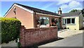
Red Nook Cottage, NW edge of Tarraby
Ordnance Survey documents indicate that a benchmark levelled at 25.710m above Newlyn Datum was verified in 1972 on the road face of a house at this location
Image: © Roger Templeman
Taken: 30 Jun 2021
0.07 miles