
IMAGES TAKEN NEAR TO
Low Moresby, WHITEHAVEN, CA28 6RR
Introduction
This page details the photographs taken nearby to CA28 6RR by members of the Geograph project.
The Geograph project started in 2005 with the aim of publishing, organising and preserving representative images for every square kilometre of Great Britain, Ireland and the Isle of Man.

There are currently over 7.5m images from over14,400 individuals and you can help contribute to the project by visiting https://www.geograph.org.uk
Image Map
Images are licensed for reuse under creativecommons.org/licenses/by-sa/2.0
Notes
- Clicking on the map will re-center to the selected point.
- The higher the marker number, the further away the image location is from the centre of the postcode.
Image Listing (41 Images Found)
Images are licensed for reuse under creativecommons.org/licenses/by-sa/2.0
Image
Details
Distance
1
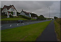
The A595, Moresby and Parton
The A595 is the boundary between Moresby and Parton here. The houses are in Moresby, the foreground pavepent in Parton.
Image: © habiloid
Taken: 15 Aug 2019
0.01 miles
5
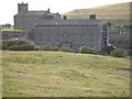
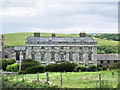
Moresby Hall manor house
With St Bridget's Church beyond. The hall is Grade 1 listed and dates from 1620. It ceased to be the manor house in 1955.
Image: © Carol Rose
Taken: 30 Jun 2007
0.12 miles
6
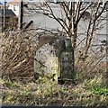
Parton Milestone
Grade II listed milestone beside the A595. "mid C19. Single sandstone block c2 ft high with chamfered top; square in plan, set diagonally to road. Painted white with rectangular
cast-iron plate to north face; border and raised sans-serif lettering picked out
in black: TO WHITEHAVEN 2 MILES. Plate missing from south face". The missing plate showed Workington 6 miles & Cockermouth 12 miles.
Image: © David Rogers
Taken: 7 Feb 2014
0.12 miles
7
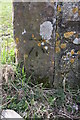
Benchmark on gatepost on SW side of road
Ordnance Survey cut mark benchmark levelled at 29.060m above Newlyn Datum
Image: © Roger Templeman
Taken: 9 Apr 2018
0.12 miles
8
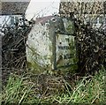
Old Milestone by the A595 in Parton
Metal plate attached to stone post by the A595, in parish of PARTON (COPELAND District), East of Police Station; 50m West of Brewery Bottom, on grass verge, on North side of road. Whitehaven plate stone, erected by the Whitehaven turnpike trust in the 19th century.
Inscription reads:-
: {plaque missing} (WORKINGTON / 6 MILES) : : TO WHITEHAVEN / 2 MILES :
Grade II Listed. List Entry Number: 1312397
https://historicengland.org.uk/listing/the-list/list-entry/1312397
Milestone Society National ID: CU_WHWO02.
Image: © GG Farrington
Taken: 25 Mar 2007
0.12 miles
10
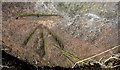
Benchmark on wall on NW side of A595 NE of Parton
Ordnance Survey cut mark benchmark described on the Bench Mark Database at www.bench-marks.org.uk/bm113448
Image: © Luke Shaw
Taken: 19 Apr 2018
0.13 miles