
IMAGES TAKEN NEAR TO
Rowantree Close, WHITEHAVEN, CA28 6LB
Introduction
This page details the photographs taken nearby to Rowantree Close, CA28 6LB by members of the Geograph project.
The Geograph project started in 2005 with the aim of publishing, organising and preserving representative images for every square kilometre of Great Britain, Ireland and the Isle of Man.

There are currently over 7.5m images from over14,400 individuals and you can help contribute to the project by visiting https://www.geograph.org.uk
Image Map
Images are licensed for reuse under creativecommons.org/licenses/by-sa/2.0
Notes
- Clicking on the map will re-center to the selected point.
- The higher the marker number, the further away the image location is from the centre of the postcode.
Image Listing (17 Images Found)
Images are licensed for reuse under creativecommons.org/licenses/by-sa/2.0
Image
Details
Distance
1

Hillside seen through petrol station/store forecourt
Between the A5094 and the A595.
Image: © Trevor Harris
Taken: 5 Jun 2018
0.06 miles
2

Curious sheep.
Good to see that there are still some sheep thriving within the town.
Image: © Harold Potts
Taken: 10 Jun 2007
0.07 miles
3
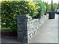
Garden Wall.
A fine example of drystone wall building. This clearly modern structure marks the property line of a small front garden, but echoes ancient structures built with the same technique, ubiquitous throughout nearby Lakeland.
Image: © Harold Potts
Taken: 11 Jun 2007
0.07 miles
4
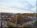
Aikbank Estate
View of houses at Aikbank looking west, with Bransty in the distance
Image: © Mary May
Taken: 14 Oct 2005
0.09 miles
5

Petrol Station, New Road
New Road (A5094) as it approaches its junction with the A595.
Image: © habiloid
Taken: 14 Aug 2019
0.09 miles
6
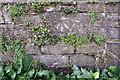
Benchmark on wall at north end of New Road
Ordnance Survey cut mark benchmark levelled at 66.138m above Newlyn Datum. There is more information at www.bench-marks.org.uk/bm112735
Image: © Roger Templeman
Taken: 9 Apr 2018
0.09 miles
7
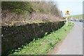
New Road approaching junction with Loop Road North
There is an OS benchmark Image on a stone in the wall by a stick propped against the wall near the left hand edge of the image
Image: © Roger Templeman
Taken: 9 Apr 2018
0.10 miles
8
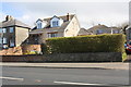
Housing on Loop Road North
There is an OS benchmark Image on the stone wall below the left hand edge of the hedge
Image: © Roger Templeman
Taken: 9 Apr 2018
0.16 miles
9
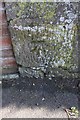
Benchmark on roadside wall of #37 Loop Road North
Ordnance Survey cut mark benchmark levelled at 72.631m above Newlyn Datum. There is more information at www.bench-marks.org.uk/bm112736
Image: © Roger Templeman
Taken: 9 Apr 2018
0.16 miles
10
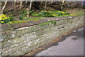
Old milestone beside the wall of New Road
Image is a close view of the milestone
Image: © Roger Templeman
Taken: 9 Apr 2018
0.18 miles