IMAGES TAKEN NEAR TO
Housesteads Road, CARLISLE, CA2 7XG
Introduction
This page details the photographs taken nearby to Housesteads Road, CA2 7XG by members of the Geograph project.
The Geograph project started in 2005 with the aim of publishing, organising and preserving representative images for every square kilometre of Great Britain, Ireland and the Isle of Man.

There are currently over 7.5m images from over14,400 individuals and you can help contribute to the project by visiting https://www.geograph.org.uk
Image Map
Images are licensed for reuse under creativecommons.org/licenses/by-sa/2.0
Notes
- Clicking on the map will re-center to the selected point.
- The higher the marker number, the further away the image location is from the centre of the postcode.
Image Listing (18 Images Found)
Images are licensed for reuse under creativecommons.org/licenses/by-sa/2.0
Image
Details
Distance
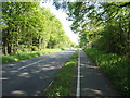
1
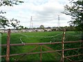
Gate, field, pylons, houses
View from Sandsfield Road, the houses backing on to the field are in Housesteads Road.
Image: © Rose and Trev Clough
Taken: 8 May 2010
0.05 miles
2
Trees off Yewdale Road, Carlisle
In a patch of open space between Yewdale Road and Lodore Drive.
Image: © Christine Johnstone
Taken: 2 Nov 2015
0.09 miles
3
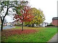
Autumn trees off Yewdale Road, Carlisle
The smaller trees are turning before the bigger ones.
Image: © Christine Johnstone
Taken: 2 Nov 2015
0.10 miles
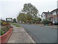
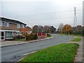
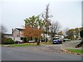
4
Birdoswald Drive, Carlisle
Running east from Housesteads Road.
Image: © Christine Johnstone
Taken: 2 Nov 2015
0.12 miles
6
Power lines crossing Housesteads Road, Carlisle
The western suburbs of Carlisle are bounded by multiple parallel power lines.
Image: © Christine Johnstone
Taken: 2 Nov 2015
0.14 miles
7
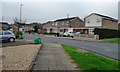
Houses on Castlesteads Drive, Carlisle
Just north of the junction with Housesteads Road.
Image: © Christine Johnstone
Taken: 2 Nov 2015
0.16 miles
8
Autumn tree, Castlesteads Drive, Carlisle
In a front garden on the south side of the road.
Image: © Christine Johnstone
Taken: 2 Nov 2015
0.18 miles
9
Autumn trees, Castlesteads Drive, Carlisle
A cul-de-sac on the north side of the main part of the road.
Image: © Christine Johnstone
Taken: 2 Nov 2015
0.20 miles
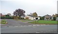
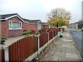
10
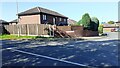
#28 Priorwood Close at Sandsfield Lane junction
Ordnance Survey documents indicate that a benchmark levelled at 46.165m above Newlyn Datum was verified in 1972 on a gatepost at this location
Image: © Roger Templeman
Taken: 4 Sep 2023
0.20 miles