
IMAGES TAKEN NEAR TO
Burgh Road, CARLISLE, CA2 7RF
Introduction
This page details the photographs taken nearby to Burgh Road, CA2 7RF by members of the Geograph project.
The Geograph project started in 2005 with the aim of publishing, organising and preserving representative images for every square kilometre of Great Britain, Ireland and the Isle of Man.

There are currently over 7.5m images from over14,400 individuals and you can help contribute to the project by visiting https://www.geograph.org.uk
Image Map
Images are licensed for reuse under creativecommons.org/licenses/by-sa/2.0
Notes
- Clicking on the map will re-center to the selected point.
- The higher the marker number, the further away the image location is from the centre of the postcode.
Image Listing (29 Images Found)
Images are licensed for reuse under creativecommons.org/licenses/by-sa/2.0
Image
Details
Distance
1
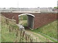
Farm track under the A689
The underpass allows a farm track to cross the busy A689 Carlisle western bypass. The public footpath does not use the underpass, instead it climbs the embankment and crosses the carriageway before descending into the field on the other side of the road.
Image: © Graham Robson
Taken: 30 Oct 2014
0.10 miles
2
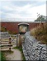
Hadrian's Wall Path passes under the new by-pass
Image: © Anthony Parkes
Taken: 5 Aug 2014
0.10 miles
5
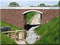
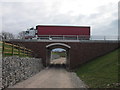
Underpass on the new A689 Carlisle Western By-pass
The Hadrian's Wall Path passes below the new road.
One advantage (for walkers) of National Trail status is that when a new road is built the Department of Transport is obliged to provide a safe crossing, as here.
Image: © David Purchase
Taken: 31 May 2013
0.12 miles
6
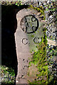
Old Boundary Marker near Knockupworth Farm, Beaumont parish
Municipal Boundary Marker near an old canal bridge, and later railway bridge, near Knockupworth Farm, Beaumont parish. Rescued by the farmer in 2012 when the bypass was built, presumably from the Carlisle and Beaumont boundary at NY3707956488.
Milestone Society National ID: CU_CCB3
Image: © Colin Smith
Taken: 4 Jul 2010
0.13 miles
7
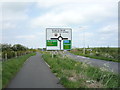
National Cycle Route 72, Knockupworth
Heading north west.
Image: © JThomas
Taken: 28 May 2016
0.13 miles
8
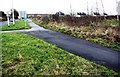
Cycle path and footpath beside Burgh Road
Image: © Roger Templeman
Taken: 8 Jan 2020
0.13 miles
9
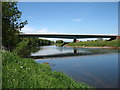
The new Carlisle Western By-pass crosses the River Eden
Seen from the Hadrian's Wall Path, the new road (the A689) goes from Junction 44 of the M6 as far as the A595, which it joins at NY 373535.
Image: © David Purchase
Taken: 31 May 2013
0.14 miles
10
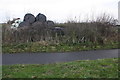
Site of former gateway off NW end of Burgh Road
Ordnance Survey records indicate that in 1971 there was a gatepost with a benchmark levelled at 26.038m above Newlyn Datum at a junction of a track with the road here.
Image: © Luke Shaw
Taken: 8 Jan 2020
0.15 miles